In short
Allow five to seven days with Machu Picchu. If possible, sleep first in the valley (Urubamba, Ollantaytambo or Pisac, at around 2,800 to 3,000 m), then in Cusco (about 3,400 m). Take the full Boleto Turístico if you are visiting both the sites above Cusco and those in the valley; it includes neither the Qorikancha temple, nor the cathedral, nor the Maras salt pans, nor Machu Picchu. Organise the valley in days by area: Pisac, then Chinchero–Maras–Moray, then Ollantaytambo before the train.
Three levels, three ways to sleep
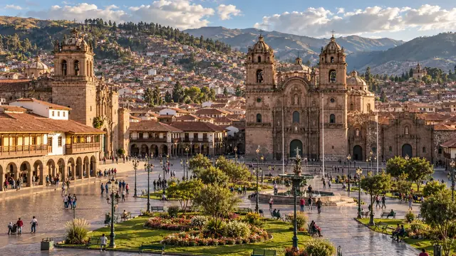
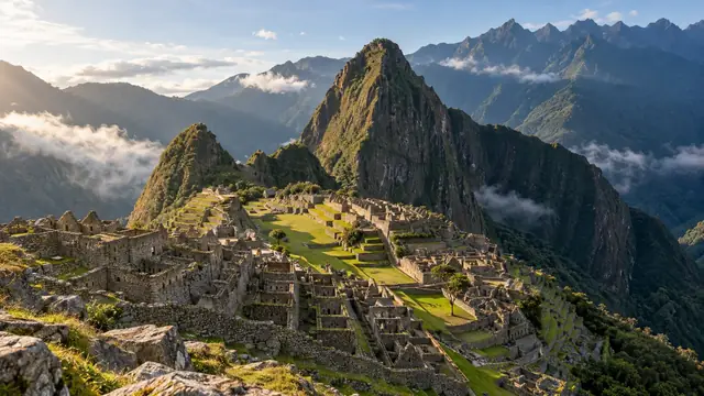
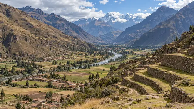
Cusco is at about 3,400 m. The Urubamba Valley (called the Vilcanota upstream) runs to the north, lower down: Pisac at about 2,970 m, Urubamba at about 2,870 m, Ollantaytambo at about 2,790 m. Between the two lies a farming plateau, higher than Cusco in places: Chinchero at about 3,750 m, Maras at about 3,300 m. Finally, Machu Picchu is at about 2,430 m.
Above 3,000 metres, the CDC recommends not climbing too fast from one night to the next; arriving in Cusco by plane from Lima means gaining more than 3,000 metres in less than an hour and a half. Hence a simple rule of organisation: the first nights in the valley, Cusco afterwards. See altitude.
| Base | Advantages | Limits | Who it suits |
|---|---|---|---|
| Cusco | Museums, restaurants, city life, departures for every excursion | The highest of the bases; steep streets; cold nights | After two or three nights lower down, or for short stays |
| Pisac | A village at the foot of a great site, a market | At the eastern end of the valley, far from the station | Those who start with Pisac and the market |
| Urubamba | A central position, quiet, accommodation in the middle of the fields | Little to see on the spot; the accommodation is spread out | An unhurried stay, by car with a driver |
| Ollantaytambo | An inhabited Inca village, a great site, the Machu Picchu station | Very busy at train times | The night before or after Machu Picchu |
| Machu Picchu Pueblo | At the foot of the site | A village focused on the site, few other visits | The day before an early entry |
The Boleto Turístico: what it covers and what it does not
The region’s main sites cannot be paid for individually: they are grouped together in the Boleto Turístico del Cusco, sold by COSITUC. The full ticket costs S/ 130 for 16 sites, valid for 10 days; a partial ticket, for a single circuit, S/ 70.
It includes: circuit I: Sacsayhuamán, Q’enqo, Puka Pukara, Tambomachay; circuit II: Qorikancha site museum, Regional History Museum, Museum of Contemporary Art, Museum of Popular Art, Centro Qosqo de Arte Nativo, Pachacútec monument, Tipón, Pikillaqta; circuit III: Pisac, Ollantaytambo, Chinchero, Moray.
In practice: the full ticket becomes worthwhile as soon as you visit two circuits, for example the sites above Cusco and those in the valley. Keep it on you throughout its period of validity and show it at the entrance to each site.
Pisac
Pisac means three separate visits. The village, on the banks of the Urubamba, was laid out in colonial times, in the 1570s, below the Inca site. The market officially takes place on Tuesdays, Thursdays and Sundays; it is at its biggest on Sundays, when the Quechua communities from the surrounding area come down to sell their produce and do their shopping, but craft stalls occupy the square every day. The Inca site stretches along a ridge, between about 3,450 and 3,510 m, above spectacular terraces.
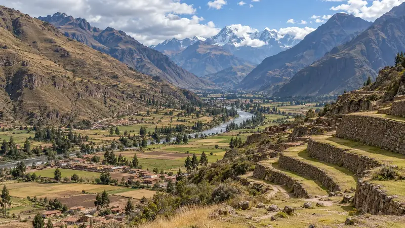
What you see there: agricultural terraces that follow the contours of the mountain, several residential quarters and a ceremonial sector in finely cut stone, all over more than 65 hectares. Historians see it as an estate of the Inca Pachacútec, at once a residence, a refuge and a place of worship; curiously, no Spanish chronicler describes it.
How to go about it: the site is more than 400 metres above the village; most visitors go up by car. If you are thinking of walking back down, ask at the ticket office whether the path to the village is open. Allow half a day for the site and the market. If you are buying, ask about the material, the origin and the price: the same fabric may be hand-woven in a neighbouring community or mass-produced.
Urubamba
Urubamba is the busiest town in the valley, halfway between Pisac and Ollantaytambo. People come here less to sightsee than to sleep: it is the most central base for heading out to Chinchero, Maras, Moray and Ollantaytambo, and the accommodation is often set in the middle of the fields, in peace and quiet. On the other hand, being in peace and quiet often means being far from everything: check the real distance to the town and to your driver before booking. PeruRail indicates a station in Urubamba depending on the season; check the timetables for your dates.
Ollantaytambo
Ollantaytambo is often reduced to its station. Yet it is one of the few Inca villages still inhabited according to its original plan: a grid of streets around enclosures (kanchas) where four houses surround a courtyard, some of which have been lived in continuously since the end of the 15th century.
The history of the place can be read in three stages. Around the middle of the 15th century, the Inca Pachacútec made it a personal estate: he rebuilt the village and had the terraces farmed by servants attached to his household. After the conquest, in 1537, the rebel Inca Manco Inca drove back a Spanish expedition from the terraces by flooding the plain, before withdrawing into the forest of Vilcabamba. In the 19th and early 20th centuries, foreign travellers, including Hiram Bingham on his way to Machu Picchu, stopped here.
What you visit:
- The Temple Hill, wrongly called “the fortress”: its functions were mainly religious. You climb the Pumatallis terraces to the unfinished Temple of the Sun and its wall of six monoliths; the view over the village and the valley rewards the climb.
- The fountains and shrines at the foot of the hill, with their channels and carved rocks.
- The village itself, to be explored on foot, away from the most touristy streets.
- The storehouses (qollqas) clinging to the surrounding hills, visible from the village.
A programme before or after the train: arrive the day before, visit the site in the late afternoon or early in the morning, and keep the village for the evening. The station is at the bottom of the village, about a kilometre from the square. PeruRail offers free left luggage there for your big bag: see Machu Picchu.
Chinchero, Maras and Moray
Three places on the same plateau, three different subjects. They combine well in a day, as long as you accept the distances: Cusco–Pisac 32 km; Pisac–Urubamba 39 km; Urubamba–Ollantaytambo 19 km; Cusco–Chinchero 27 km; Chinchero–Maras 22 km; Maras–Moray 8 km; Moray–Maras salt pans 17 km; salt pans–Urubamba 19 km; Cusco–Tipón 24 km.
Chinchero is a plateau village, the highest point of the day, at about 3,750 m. You visit an Inca site attributed to Túpac Yupanqui, included in circuit III of the Boleto Turístico, a colonial church built on its walls, and you meet weavers: the village is one of the centres of the region’s traditional textiles, studied by anthropologists since the 1970s. Distinguish the commercial demonstration, where a dye is shown in a few minutes before you move on to the shop, from the workshop where you take the time to understand spinning, dye plants and weaving. The latter is arranged in advance and paid for as a visit. On Sundays, a traditional fair livens up the village. Everything is detailed on the Chinchero page, with our advice for buying a textile without paying alpaca prices for a blend.
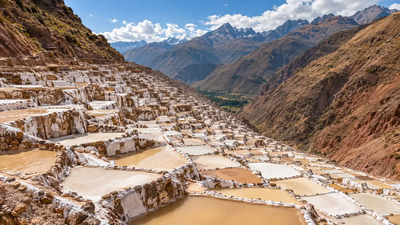
Maras is a village, separate from its salt pans a few kilometres away, at the bottom of a ravine that runs down to the Urubamba. A very salty spring is divided, through a network of small channels, among hundreds of shallow, terraced pools, worked by families from the community. The water evaporates in the sun, the salt crystallises, then it is scraped off in successive layers, from the finest to the coarsest. The system is presented locally as inherited from Inca times. Since 2019, the company that manages the salt pans has forbidden visitors to walk between the pools: you look from the paths. Entry is paid separately; it is not in the Boleto Turístico.
Moray is surprising: terraces arranged in concentric circles in natural hollows, at about 3,500 m, the largest of which is about thirty metres deep. Today, a significant difference in temperature is measured between the top and the bottom of the circles. Hence the hypothesis, often presented as a certainty, of an “agricultural laboratory” where the Incas acclimatised plants: it remains an interpretation, supported by the shape of the place and by soils brought in from elsewhere, with no text to confirm it. In February 2010, after exceptional rain, part of the large circle collapsed and was restored: stay on the paths.
Santa Teresa and the Cocalmayo hot springs
On the other side of the Abra Málaga pass, the road from Ollantaytambo goes down towards the province of La Convención. Santa Teresa, a small town on the banks of the Urubamba, at around about 1,550 m, is a stop on the way to Machu Picchu via Hidroeléctrica and the gateway to the Cocalmayo hot springs. It is not a half-day excursion: about 200 km: 178 km to Santa María, then 25 km to Santa Teresa; the Cocalmayo hot springs are 3 km from the town. Do not confuse these springs with those of Machu Picchu Pueblo (Aguas Calientes). Access, organisation and precautions after rain: see Santa Teresa and Cocalmayo.
Tipón
Tipón, half an hour south-east of Cusco, is the best place to understand the Inca art of water. A spring feeds a monumental fountain, then a network of channels, falls and pools that irrigate a series of large right-angled terraces. The site stretches between 3,250 and 3,960 metres and covers 239 hectares; in 2006, the American Society of Civil Engineers listed it among the great historic civil engineering landmarks. It was probably an estate of the Inca elite, perhaps of Pachacútec or his son.
Tipón is included in circuit II of the Boleto Turístico, as is Pikillaqta, close by: a vast complex of the Wari culture, occupied from about 550 to 1100, several centuries before the Incas, and left unfinished when it was abandoned. The two sites can be visited in half a day from Cusco. The village of Tipón is also known for oven-roasted cuy; confirm an address before you go. See Where to eat cuy?
Vinicunca and Palcoyo
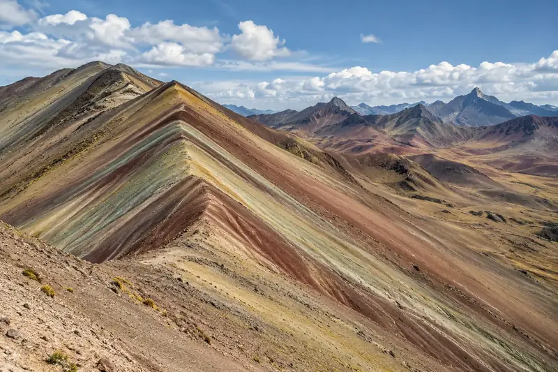
Vinicunca, which everyone also calls the Mountain of 7 Colours, and Palcoyo, the other “coloured mountain”, owe their bands of colour to layers of different sediments and minerals (red clays, sandstone, marl), exposed by erosion. They are not equivalent:
| Vinicunca (the Mountain of 7 Colours) | Palcoyo (Palccoyo) | |
|---|---|---|
| Altitude | Summit at about 5,040 m | Community at about 4,130 m, hills above |
| Access | About two hours’ drive from Cusco, then a walk of several kilometres (about 5 km according to published descriptions); or a longer road via Pitumarca and a shorter but steep walk | A road to the community, then a shorter walk |
| What you see | A great striped ridge, much photographed, often very crowded | Several coloured hills and a “stone forest” (Yuraq Qaqa); a colonial chapel with a thatched roof |
| Effort | High: a long walk above 4,500 m | Moderate, but still above 4,000 m |
The FDFA advises doing the Vinicunca excursion with a local guide. The rain is heavy from December to February, and it is bitterly cold in the early morning all year round. Keep them for the end of your stay, after a few days in Cusco or in the valley: your body will have had time to get used to the altitude. And keep the option of turning back along the way.
Comparing two offers all the way through. A shared excursion fare, private transport and a service with a French-speaking guide are not the same thing. Write down side by side: number of travellers, departure time, guide and language, community entry fees, meals, any back-up horse and cancellation conditions. See the recorded prices.
The valley in two or three days
A suggestion, to adapt to your accommodation:
- Day 1, the east of the valley. Cusco, then Pisac: the site in the morning (up by car, down on foot), the market at midday, preferably on a Tuesday, Thursday or Sunday. A night in Urubamba.
- Day 2, the plateau. Chinchero in the morning (site, church, a weaving workshop arranged in advance), Maras and Moray in the early afternoon, the salt pans at the end of the day before going back down to the valley. A night in Urubamba or Ollantaytambo.
- Day 3, Ollantaytambo. The site early in the morning, the village, then the train to Machu Picchu Pueblo.
Tipón and Pikillaqta, to the south-east, are better placed as a half-day from Cusco; Vinicunca or Palcoyo as a whole day, at the end of your stay.
Before setting these days in stone: buy the Machu Picchu ticket, then the train, then the nights. The entry time at the site decides whether you spend the night in Ollantaytambo or in Machu Picchu Pueblo. For reference, a Cusco provider publishes an indicative price per vehicle for the Maras–Moray loop with a driver and waiting time, entry fees and guide excluded (see below).
Hiking: do not confuse trail, mountain and summit
The Inca Trail, the Salkantay programmes and the walks to Choquequirao correspond to different experiences. A “Salkantay trek” is not the technical ascent of the summit of Salkantay. Our hiking page details the questions to ask.
Frequently asked questions
Should you sleep in Cusco or in the Sacred Valley?
Both. You can start with two quiet days in Cusco, or go down first into the valley, some 500 metres lower, which makes the first nights easier; Ollantaytambo is also the station for Machu Picchu. Either way, take your time at the start.
Is the Boleto Turístico worth it?
Yes, as soon as you visit Pisac, Ollantaytambo, Chinchero or Moray: these sites cannot be paid for individually at the ticket office. The full ticket is valid for ten days for sixteen sites; the partial tickets cover a single circuit.
Vinicunca or Palcoyo?
Vinicunca, the Mountain of 7 Colours, is the most famous and the highest: a long drive then a walk above 4,500 m. Palcoyo requires a shorter walk, still above 4,000 m, with several coloured hills and a stone forest. Keep them for the end of your stay, after a few days at altitude.
Sources and dates
11 sources
Prices, opening hours and rules change: every piece of information cited links to its source, with the date it was consulted.
Figures and rules cited
- about 3,400 m: Altitude of Cusco (centre) (Cusco) . Wikidata gives 3,399 m, the CDC about 3,350 m: the city spreads over several tens of metres of height.
Press or reseller: Wikidata, Cuzco (Q5582862), altitude (new tab) · consulted on 1 October 2026 - about 2,970 m: Altitude of Pisac (village, on the banks of the Urubamba) (Pisac, Sacred Valley)
Press or reseller: Wikidata, Písac (Q950398), altitude (new tab) · consulted on 1 October 2026 - about 2,870 m: Altitude of Urubamba (town) (Urubamba, Sacred Valley)
Press or reseller: Wikidata, Urubamba (Q2304483), altitude (new tab) · consulted on 1 October 2026 - about 2,790 m: Altitude of Ollantaytambo (village) (Ollantaytambo, Sacred Valley)
Press or reseller: Wikidata, Ollantaytambo (Q916382), altitude (new tab) · consulted on 1 October 2026 - about 3,750 m: Altitude of Chinchero (village, on the plateau) (Chinchero)
Official source: Cusco Directorate of Culture, Chinchero archaeological park (average altitude 3,750 m) (new tab) · consulted on 7 October 2026 - about 3,300 m: Altitude of Maras (village) (Maras)
Press or reseller: Wikidata, Maras (Q1026235), altitude (new tab) · consulted on 1 October 2026 - about 2,430 m: Altitude of the Machu Picchu site (Machu Picchu)
Press or reseller: Wikidata, Machu Picchu (Q676203), altitude (new tab) · consulted on 1 October 2026 - S/ 130 for 16 sites, valid for 10 days: Full Boleto Turístico del Cusco, foreign adult visitor (Cusco and the Sacred Valley) (Foreign adult (S/ 70 for a foreign student))
Site management: COSITUC, Boleto Turístico del Cusco (new tab) · consulted on 1 October 2026 - S/ 70: Partial Boleto Turístico del Cusco (one circuit), foreign adult visitor (Cusco and the Sacred Valley) (Foreign adult) . Circuit I: four sites above Cusco, 1 day. Circuit II: eight museums and sites including Tipón and Pikillaqta, 2 days. Circuit III: Pisac, Ollantaytambo, Chinchero and Moray, 2 days.
Site management: COSITUC, Boleto Turístico del Cusco (new tab) · consulted on 1 October 2026 - circuit I: Sacsayhuamán, Q’enqo, Puka Pukara, Tambomachay; circuit II: Qorikancha site museum, Regional History Museum, Museum of Contemporary Art, Museum of Popular Art, Centro Qosqo de Arte Nativo, Pachacútec monument, Tipón, Pikillaqta; circuit III: Pisac, Ollantaytambo, Chinchero, Moray: Sites included in the Boleto Turístico del Cusco (16 in total) (Cusco and the Sacred Valley) . It does not include the Qorikancha temple (Santo Domingo convent), the cathedral and the churches of the archbishopric circuit, the Maras salt pans or Machu Picchu.
Site management: COSITUC, Boleto Turístico del Cusco (new tab) · consulted on 2 October 2026 - between about 3,450 and 3,510 m: Altitude of the Inca site of Pisac, on the ridge above the village (Pisac archaeological park) . That is about 500 m above the village.
Press or reseller: Wikipedia (English), Pisac (3,446 to 3,514 m) (new tab) · consulted on 2 October 2026 - Cusco–Pisac 32 km; Pisac–Urubamba 39 km; Urubamba–Ollantaytambo 19 km; Cusco–Chinchero 27 km; Chinchero–Maras 22 km; Maras–Moray 8 km; Moray–Maras salt pans 17 km; salt pans–Urubamba 19 km; Cusco–Tipón 24 km: Road distances between the stops in the Sacred Valley (Cusco and the Sacred Valley) . Centre-to-centre distances (or to the site entrance). Mountain roads: allow much more than the calculated time, especially beyond Moray and towards the salt pans.
Press or reseller: Road routes calculated on OpenStreetMap (FOSSGIS routing server) (new tab) · consulted on 2 October 2026 - about 3,500 m: Altitude of the Moray plateau (Moray, Maras)
Press or reseller: Wikipedia (English), Moray (new tab) · consulted on 2 October 2026 - about 1,550 m: Altitude of Santa Teresa (town, La Convención province) (Santa Teresa, La Convención, Cusco) . Terrain model at the town centre (1,553 m); the district rises much higher. The Cocalmayo hot springs are at around 1,500 m according to PROMPERÚ.
Press or reseller: SRTM 30 m terrain model (OpenTopoData API), at the town’s point on OpenStreetMap (new tab) · consulted on 7 October 2026 - about 200 km: 178 km to Santa María, then 25 km to Santa Teresa; the Cocalmayo hot springs are 3 km from the town: Road distance from Cusco to Santa Teresa via Ollantaytambo, the Abra Málaga pass and Santa María (Cusco–Santa Teresa) . The calculator estimates nearly five hours’ drive from Cusco without stopping; a mountain road prone to landslides in the rainy season.
Press or reseller: Road routes calculated on OpenStreetMap (FOSSGIS routing server) (new tab) · consulted on 7 October 2026 - about 5,040 m: Altitude of the summit of Vinicunca (the Mountain of 7 Colours) (Vinicunca, provinces of Quispicanchi and Canchis) . The same article also gives “about 5,200 m” for the pass: bear in mind that the walk takes place above 4,500 m.
Press or reseller: Wikipedia (English), Vinicunca (5,036 m) (new tab) · consulted on 2 October 2026 - about 4,130 m: Altitude of the Palccoyo community (starting point for visiting the coloured hills) (Palccoyo, Checacupe district) . The coloured hills rise above the community: the walk takes place higher up.
Press or reseller: Wikipedia (Spanish), Palccoyo (4,134 m) (new tab) · consulted on 2 October 2026
Sources consulted
- Inacal, checking labels and origin for a safe purchase (16 June 2026) (new tab) (consulted on 7 October 2026)
- Inacal, technical standards for artisanal weaving and embroidery, labelling (1 March 2022) (new tab) (consulted on 7 October 2026)
- alpaca.ch (a Swiss seller of alpaca clothing), fibre categories (“baby alpaca”) (new tab) (consulted on 7 October 2026)
- COSITUC, Boleto Turístico del Cusco (sites, circuits, prices) (new tab) (consulted on 2 October 2026)
- UNESCO, City of Cuzco (new tab) (consulted on 2 October 2026)
- CDC Yellow Book, High-Altitude Travel and Altitude Illness (new tab) (consulted on 1 October 2026)
- Wikipedia (English), Pisac, Ollantaytambo, Moray, Maras, Tipón, Vinicunca (new tab) (consulted on 2 October 2026)
- Wikipedia (Spanish), Palccoyo (new tab) (consulted on 2 October 2026)
- PeruRail, frequently asked questions (valley stations) (new tab) (consulted on 2 October 2026)
- FDFA, Conseils pour les voyages – Pérou (travel advice, in French: Cusco, Vinicunca) (new tab) (consulted on 1 October 2026)
- PROMPERÚ, Tipón archaeological site (new tab) (consulted on 25 September 2026)
How we choose and date our information: our method. Has something changed? Let us know.