In short
Allow a week. Two first days without effort at altitude (Huaraz, Wilcahuaín, Monterrey), then higher and higher outings: the Llanganuco lakes or Laguna Churup, Chavín de Huántar for a cultural day, then Laguna 69 at around 4,600 metres, and a spare day. Since 2025, outings have been made with operators authorised by SERNANP.
The Cordillera Blanca, a few pointers
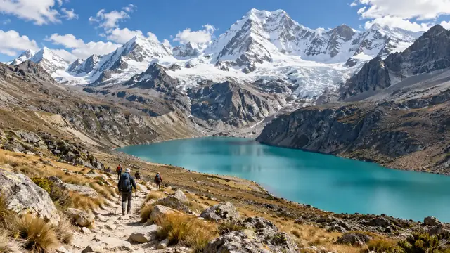
Huascarán National Park protects most of the Cordillera Blanca: 340,000 hectares, about 150 km from north to south, listed by UNESCO in 1985. It owes its name to Huascarán, the highest point in Peru. It has more than four hundred lakes, forests of queñual (Polylepis), the spectacular Puya raimondii, a giant bromeliad that flowers only once in its life, and, with luck, condors, vicuñas and spectacled bears.
A mountain range that is changing. The glaciers are retreating fast. The Pastoruri glacier has lost more than a fifth of its surface area in thirty years; according to a park official, it no longer accumulates ice in winter. The “climate change route” that leads there shows this retreat on the spot.
A mountain that has killed. On 31 May 1970, an earthquake off the coast broke away part of the north face of Huascarán. The avalanche of ice, rock and mud buried the town of Yungay and the village of Ranrahirca; the earthquake killed more than 66,000 people in the region. The site of the old Yungay is now a national cemetery, where no excavation takes place: it is visited in silence, on the road to Llanganuco. Huaraz, largely destroyed by the earthquake, has been rebuilt: little of its old architecture remains. To place this earthquake among those that have marked the country, see earthquakes and tsunamis in Peru.
Huaraz or Caraz: choosing your base
| Huaraz | Caraz | |
|---|---|---|
| Sleeping altitude | about 3,050 m | about 2,260 m |
| Services | Agencies, equipment shops, restaurants, most organised departures | More limited, but enough for a simple stay |
| Atmosphere | A lively town, rebuilt after 1970 | A small, quiet town that has kept the architecture and pace of an Andean market town |
| Close to | Churup, Pastoruri, Chavín, Monterrey | Laguna Parón, Llanganuco, the north of the valley |
| Who it suits | A first stay, varied outings with agencies | A second stay, walkers looking for peace and quiet |
Distances: Huaraz–Caraz 69 km; Huaraz–Yungay 60 km; Yungay–Llanganuco lakes 29 km; Huaraz–Cebollapampa (start of Laguna 69) 89 km; Caraz–Cebollapampa 46 km; Caraz–Laguna Parón 28 km; Huaraz–Pitec (start of Laguna Churup) 18 km; Huaraz–Chavín de Huántar 104 km; Huaraz–Monterrey 7 km. The two towns are linked by the road along the Santa Valley, the Callejón de Huaylas.
The outings compared
| Outing | Starting point and access | Altitude | Effort | When to place it |
|---|---|---|---|---|
| Wilcahuaín | A few kilometres from Huaraz | Close to that of the town | Low | Day 1 or 2: a Wari stone site, with no effort |
| Monterrey baths | 7 km north of Huaraz | Close to that of the town | None | A rest day |
| Llanganuco lakes | A road from Yungay, a short stroll | about 3,850 m | Low | The first outing into the park |
| Laguna Churup | A road to Pitec, then a walk | Much higher than Huaraz | Moderate to high | An acclimatisation outing, after two or three days |
| Chavín de Huántar | 104 km, over a pass | about 3,180 m | Low | A cultural day, lower than the lakes |
| Laguna Parón | A track from Caraz | High | Low to moderate | From Caraz, after acclimatisation |
| Pastoruri | A road south via Recuay, a short walk | Around 5,000 m | Moderate, at very high altitude | At the end of the stay |
| Laguna 69 | Cebollapampa, then a walk of about three hours up | about 4,600 m | High | After at least three or four days |
The altitudes of Churup, Parón and Pastoruri are not all published by an official source we consulted; ask your provider for them. The park entry fee: S/ 30 for one day, S/ 60 for two to three days, S/ 150 for four to thirty days (general rate); you must use operators authorised by SERNANP.
Laguna 69: a real day in the mountains
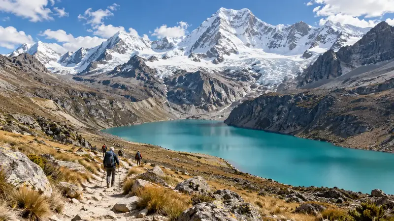
Laguna 69 is the most famous outing in the Cordillera Blanca: a turquoise lake at the foot of Chacraraju, fed by a waterfall. Its name comes from an administrative numbering, as there was no traditional name when the park was created in 1975. PROMPERÚ presents access on foot from the Cebollapampa campsite and gives about three hours for the way up, along the stream and its waterfalls: that includes neither the way back nor the four to five hours of driving there and back from Huaraz.
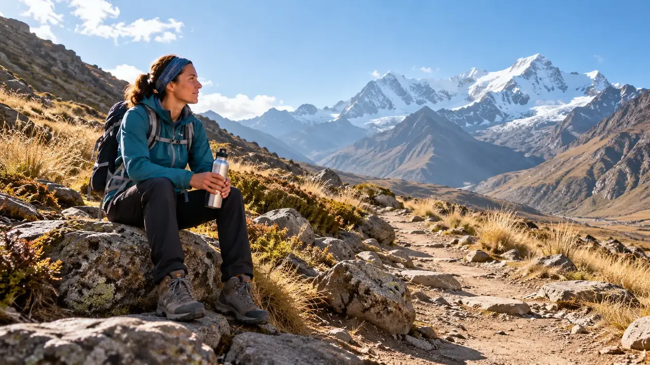
In practice, it is a twelve-hour day, with a departure before dawn, a steady and then steeper climb towards the end, and the return along the same path. It should come after several days of acclimatisation and an intermediate outing. Turn back if headaches, breathlessness or nausea set in: the lake is not worth the risk of a high-altitude oedema.
A flexible progression
A suggestion for a week, with no medical guarantee: everyone reacts differently to altitude, and the CDC points out that physical fitness does not protect you.
- Day 1. Arrival, rest, a slow walk around Huaraz and a visit to the Áncash Archaeological Museum, opposite the Plaza de Armas, with its park of monoliths from the Recuay culture.
- Day 2. Wilcahuaín, a stone complex from the Wari period, a few kilometres from the town; the afternoon at the Monterrey baths.
- Day 3. The Llanganuco lakes and a stop at the old Yungay.
- Day 4. Chavín de Huántar, a cultural day.
- Day 5. Laguna Churup, if the previous days have gone well.
- Day 6. Laguna 69.
- Day 7. A spare day: weather, tiredness, or Pastoruri if all is well.
Above 3,000 metres, the CDC recommends not increasing your sleeping altitude too quickly; here, you always sleep in Huaraz or Caraz and go up on day trips, which helps. See altitude.
A cultural day: Chavín de Huántar
On the other side of the Cordillera Blanca, at the entrance to the Conchucos Valley, Chavín de Huántar was, between about 1200 and 500 BCE, one of the great religious centres of the Andes, where people came to consult an oracle. UNESCO listed it in 1985.
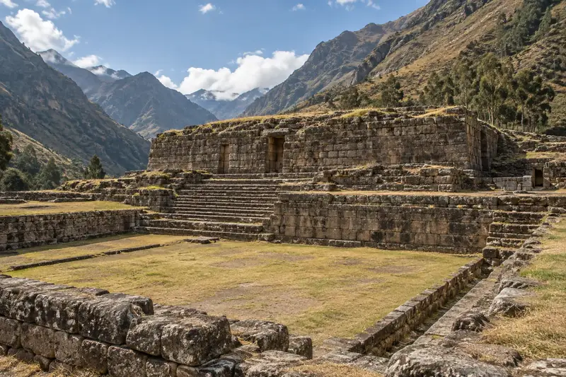
What you see: the stone platforms and the sunken circular plaza, then, inside the Old Temple, a network of dark, narrow galleries where you walk bent over; at the crossing of two of them still stands the Lanzón, a monolith carved with a fanged deity, in its original place. The Chavín National Museum, in the village, holds the “tenon heads”, carved heads once set into the walls of the temple.
The journey crosses a high pass before going back down: it is a long day on the road, but the site is lower than most of the lakes, which makes it a good transition day.
Santa Cruz, Huayhuash and day outings
| Day excursions | Santa Cruz trek | Huayhuash circuit | |
|---|---|---|---|
| Where | Cordillera Blanca, from Huaraz or Caraz | Cordillera Blanca, inside the park | Cordillera Huayhuash, to the south, outside the park |
| Length | A day | Three to four days | Ten to fourteen days for the full circuit, about 130 km |
| Highest point | Depending on the outing, up to about 4,600 m | The Punta Unión pass, at around 4,750 m | Several passes above 5,000 m |
| Nights | In Huaraz or Caraz | In a tent, in the valleys | In a tent, almost always above 4,000 m |
| Who it suits | Everyone, after acclimatisation | Fit walkers, with an authorised agency | Experienced trekkers, very well acclimatised |
The Cordillera Huayhuash, more compact and wilder, has seven peaks over 6,000 metres, including Yerupajá, the second-highest summit in Peru; it has been protected since 2002 as a reserved zone. Its starting villages are Chiquián and Cajatambo. For these treks, build the whole stay around them: acclimatisation first, the trek next, the buffer last, and ask for the actual walking hours, the elevation gains, the nights, the equipment provided and the evacuation plan.
Caraz: another base in the Callejón de Huaylas
Caraz, 69 km north of Huaraz and noticeably lower, is a small, quiet town that partly escaped the destruction of 1970. It suits those who want to sleep lower, walk in the north of the valley and reach Laguna Parón, a large lake surrounded by peaks, along a 28 km track. The departures for Laguna 69 are closer from here than from Huaraz. On the other hand, there are fewer agencies and services: book your provider in advance. Sleeping closer to a starting point simplifies a day, as long as the accommodation and the guiding meet your expectations.
A properly licensed provider, route by route
The rules are not the same everywhere around Huaraz:
| Outing | What the sources consulted on 7 October 2026 say |
|---|---|
| Laguna 69 and Nevado Pisco (Llanganuco sector) | A specific SERNANP measure: visits only with an agency under contract with SERNANP, which buys the digital ticket: since 9 February 2026 for Laguna 69, since 1 April 2026 for Nevado Pisco |
| Other routes in the park (Churup, the Llanganuco lakes, Santa Cruz, Parón) | The Llanganuco lakes (Chinancocha) are still sold directly according to the press; for the others, the park’s visitor information states that visits to the protected area are made with authorised operators: ask the park or your provider about the rule for your route |
| Outside the park (Wilcahuaín, Chavín de Huántar, Cordillera Huayhuash) | Other rules: a site ticket for Chavín, community organisation and a specialist agency for Huayhuash |
A publication from February 2026 confirms that this formalisation is continuing in the park. Before choosing, check the provider’s status on the park’s list of authorised operators, and ask what the price includes: transport, guide, park entry, meals, equipment.
Be wary of old tutorials claiming that you can simply set off on your own with an entry ticket. And check that your insurance covers high-altitude hiking and mountain rescue.
Frequently asked questions
Can you do Laguna 69 on the second day?
It is not advisable: the lake is at around 4,600 metres and the walk takes about three hours on the way up, after several hours on the road. Place it after at least three or four days in the region, and after an intermediate outing such as Llanganuco or Churup.
Do you need a guide or an agency?
It depends on the outing. For Laguna 69 and Nevado Pisco, visits only with an agency under contract with SERNANP, which buys the digital ticket: since 9 February 2026 for Laguna 69, since 1 April 2026 for Nevado Pisco. For the rest of the park, SERNANP’s visitor information states that visits are made with authorised operators; ask the park or your provider about the rule for the route you have chosen (Churup, the Llanganuco lakes, Santa Cruz, Parón). Outside the park (Wilcahuaín, Chavín, Huayhuash), these rules do not apply as such.
Huaraz or Caraz?
Huaraz for the services, the agencies and town life; Caraz for peace and quiet, a lower altitude and proximity to Laguna Parón and the north of the valley.
Sources and dates
9 sources
Prices, opening hours and rules change: every piece of information cited links to its source, with the date it was consulted.
Figures and rules cited
- visits only with an agency under contract with SERNANP, which buys the digital ticket: since 9 February 2026 for Laguna 69, since 1 April 2026 for Nevado Pisco: Laguna 69 and Nevado Pisco (Llanganuco sector): access through a contracted company (Huascarán National Park, Llanganuco sector) . The park’s other circuits, such as Chinancocha lake at Llanganuco, are still sold directly, online or at the checkpoints, according to Gestión.
Press or reseller: Gestión, Laguna 69 and Nevado Pisco: visits with authorised agencies only (27 January 2026) (new tab) , published on 27 January 2026 · consulted on 8 October 2026 - about 3,050 m: Altitude of Huaraz (town) (Huaraz)
Press or reseller: Wikidata, Huaraz (Q793809), altitude (new tab) · consulted on 1 October 2026 - about 2,260 m: Altitude of Caraz (town) (Caraz)
Press or reseller: Wikidata, Caraz (Q1035471), altitude (new tab) · consulted on 1 October 2026 - Huaraz–Caraz 69 km; Huaraz–Yungay 60 km; Yungay–Llanganuco lakes 29 km; Huaraz–Cebollapampa (start of Laguna 69) 89 km; Caraz–Cebollapampa 46 km; Caraz–Laguna Parón 28 km; Huaraz–Pitec (start of Laguna Churup) 18 km; Huaraz–Chavín de Huántar 104 km; Huaraz–Monterrey 7 km: Road distances from Huaraz and Caraz to the trailheads (Callejón de Huaylas) . The tracks to Llanganuco, Parón and Pitec are slow: allow much more than the calculated time.
Press or reseller: Road routes calculated on OpenStreetMap (FOSSGIS routing server) (new tab) · consulted on 2 October 2026 - about 3,850 m: Altitude of Chinancocha lake (Llanganuco) (Llanganuco lakes, Yungay)
Press or reseller: Wikipedia (English), Llanganuco Lakes (new tab) · consulted on 2 October 2026 - about 3,180 m: Altitude of the Chavín de Huántar site (Chavín de Huántar, Conchucos valley)
Press or reseller: Wikipedia (English), Chavín de Huántar (new tab) · consulted on 2 October 2026 - about 4,600 m: Altitude of Laguna 69 (Huascarán National Park) (Laguna 69, Cordillera Blanca) . Wikidata gives 4,625 m.
Official source: PROMPERÚ (Y tú qué planes), Laguna 69 (4,604 m) (new tab) · consulted on 26 September 2026 - S/ 30 for one day, S/ 60 for two to three days, S/ 150 for four to thirty days (general rate); you must use operators authorised by SERNANP: Huascarán National Park: entry fee and the rule on operators (Huascarán National Park, Cordillera Blanca) . The rule on operators appears on the park’s visitor page, for the protected area; how it applies route by route (Churup, Llanganuco lakes, Santa Cruz, Parón) should be confirmed with the park. Separate rate for the Laguna 69 and Pico Mateo routes; Peruvian adults S/ 12 for one day. Register at the checkpoints.
Site management: SERNANP, Parque Nacional Huascarán (new tab) · consulted on 7 October 2026
Sources consulted
- Gestión, Laguna 69 (from 9 February 2026) and Nevado Pisco (from 1 April 2026): authorised agencies only (27 January 2026) (new tab) (consulted on 8 October 2026)
- SERNANP, announcement of the regulation of Laguna 69 and Nevado Pisco (5 August 2025) (new tab) (consulted on 7 October 2026)
- SERNANP, Parque Nacional Huascarán (prices, routes, rules) (new tab) (consulted on 2 October 2026)
- SERNANP: regulation of activities on the Llanganuco circuits (5 August 2025) (new tab) (consulted on 26 September 2026)
- El Peruano: formalisation of new operators (February 2026) (new tab) (consulted on 26 September 2026)
- PROMPERÚ (Y tú qué planes), Laguna 69 (new tab) (consulted on 26 September 2026)
- UNESCO, Chavin (Archaeological Site) (new tab) (consulted on 2 October 2026)
- Wikipedia (English), Huaraz, Caraz, Huascarán National Park, Pastoruri Glacier, Llanganuco Lakes, Cordillera Huayhuash, Chavín de Huántar, 1970 Ancash earthquake (new tab) (consulted on 2 October 2026)
- CDC Yellow Book, High-Altitude Travel and Altitude Illness (new tab) (consulted on 1 October 2026)
How we choose and date our information: our method. Has something changed? Let us know.