
In short
Pachacámac and Punta Hermosa are easy half-days or days out from Miraflores. Caral and Lachay are long days to the north, best done with a driver. Lunahuaná is better with a night. Marcahuasi and Huancaya, in the mountains, need two or three days and proper preparation for the altitude.
The capital has its own section; this page brings together the outings beyond the city. Distances from Miraflores: Pachacámac 24 km; Punta Hermosa 36 km; Lachay 115 km; San Pedro de Casta (Marcahuasi) 96 km; Lunahuaná 173 km; Caral 193 km; Huancaya 222 km via the central highway.
A day or two nights?
| Outing | Recommended format | Departure and return | Fallback if conditions change |
|---|---|---|---|
| Pachacámac | Half a day | Leave at 9:00, back in the early afternoon | The museum alone is enough for a visit in great heat |
| Punta Hermosa | A day | Leave in the morning, back before nightfall | A swimming beach or a walk if the swell is too strong |
| Lachay | A long day | Leave at 7:00, back around 18:00 | Out of season, another day in Lima rather than a dry desert |
| Caral | A long day | Leave at 6:30, back in the evening | Áspero, on the coast, if you are short of time |
| Lunahuaná | One or two nights | Leave in the morning, back the next day | Bodegas and the Incahuasi site if the river is closed |
| Marcahuasi | Two days, one night camping | A very early start on the first day | Go back down to San Pedro de Casta at the slightest symptom |
| Huancaya | Three days, two nights | A day on the road on the way there, another on the way back | Stay in the village, without walking at altitude |
The departure and return times are suggestions: getting out of Lima alone can take more than an hour, and the Sunday evening return is the busiest.
Pachacámac and Lurín
What it was. For more than a thousand years, Pachacámac was the great sanctuary of the central coast: an oracle people came to consult from all over the Andes, which was believed to predict the future and command earthquakes. The museum traces its long history: the Lima culture from 200 CE, then the Wari empire, then the Ychsma lords, and finally the Incas, who settled there around 1470 and built a Temple of the Sun and a palace of the chosen women (acllawasi). The Spanish arrived in 1533; the sanctuary was abandoned.
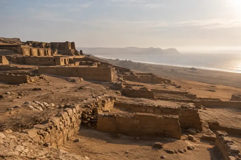
What you see. The museum, opened in a contemporary building that blends into the landscape, holds the Pachacámac idol, a carved wooden post 2.34 metres high found in the Painted Temple and dated to the Wari period, and a textile door decorated with spondylus shells. The archaeological circuit then takes in the mud-brick pyramids with ramps, the Painted Temple, the Temple of the Sun, set on a hill facing the sea, and the acllawasi.
| Practical details | Detail |
|---|---|
| Visiting conditions | one ticket gives access to the museum and the archaeological circuit; independent official guides, to be hired near the ticket office; electric carts and wheelchairs for visitors with reduced mobility |
| Length | An hour for the museum, one to two hours for the circuit |
| What to bring | A hat, water: there is almost no shade on the circuit |
Lurín, Pachacámac, the village. Do not confuse three things: the sanctuary, in the district of Lurín, by the sea; the Lurín Valley, a farming oasis that runs up towards the Andes; and the district of Pachacámac, further inland, with its haciendas, its Peruvian Paso horse farms and its country restaurants. The museum works with women from neighbouring communities who produce crafts inspired by the site: its shop is the most direct way to support them.
Punta Hermosa
Punta Hermosa, some forty kilometres south of Miraflores, is one of the first seaside resorts south of Lima, and has become one of the cradles of Peruvian surfing. The district has a string of beaches: El Silencio, Caballeros, Señoritas, Playa Norte, Playa Negra, Kontiki. Further south, Punta Negra and San Bartolo continue the coast.
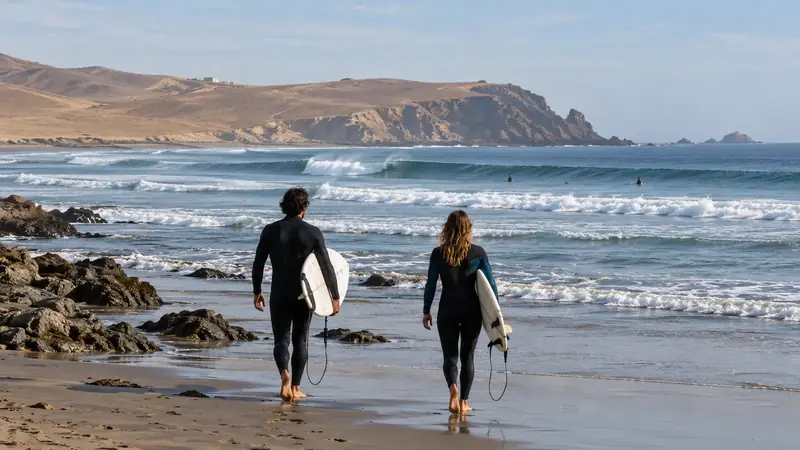
Beach or surf? They are not the same days out.
- For the beach, the southern summer (January to March) is the season; the beaches are then very crowded at weekends. The water stays cool all year round, because of the Humboldt Current.
- For surfing, the coast receives swell all year round. Señoritas and Caballeros are renowned waves, Caballeros above all for its big waves for experienced surfers only; offshore, Pico Alto is a big-wave break for specialists only. A beginner goes through a school, which chooses the beach of the day according to the swell.
See our surfing guide. This page does not recommend any accommodation in Punta Hermosa.
Lunahuaná
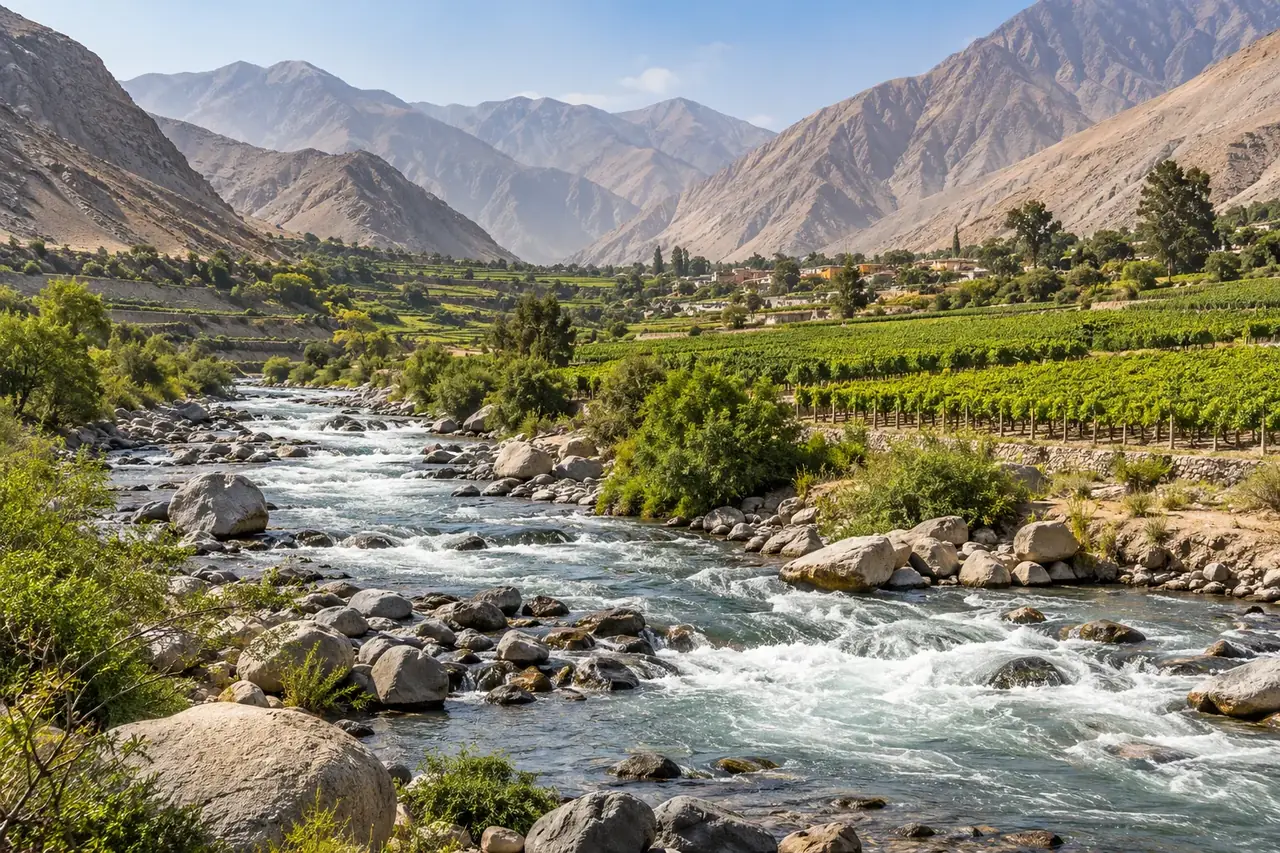
Lunahuaná is a village in the valley of the Cañete River, some 180 km south-east of Lima, at the foot of the Andes, at an altitude of about 500 metres. The valley lives from grapes, orchards and, for a few decades now, white-water sports.
Three ways to experience it.
| Rafting | Bodegas | Walks and heritage | |
|---|---|---|---|
| What it is | Rafting down the Cañete River with an operator | Visits to wineries producing pisco and wine, notably from the uvina grape, specific to the valley | The village, its Santiago Apóstol church (completed in 1690), the Inca site of Incahuasi, a quarter of an hour towards Cañete |
| Season | high water and class II to IV rapids from November to April; low, calmer water from May to October | All year round; grape harvest in summer | All year round |
| Who it suits | Depending on the river level: beginners in the low season, sporty types in the high season | Everyone, as long as no one drives afterwards | Everyone |
Before rafting, ask about the level of the day’s rapids, the equipment provided (helmet, life jacket, wetsuit), the number of guides per boat and the procedure if someone falls in. When the river is in flood, the authorities close it: have a plan B.
One or two nights. With three hours on the road each way, a day trip leaves little time on the spot. A night lets you raft one day and visit the bodegas the next, without rushing.
Caral
Why go. The sacred city of Caral, in the Supe Valley, is one of the oldest urban centres in the Americas: occupied from about 2600 to 2000 BCE, it is contemporary with the great pyramids of Egypt. UNESCO listed it in 2009. Without ceramics or writing, the Caral society built platform pyramids, a sunken circular amphitheatre, plazas and residential quarters, over more than sixty hectares. The excavations carried out since the 1990s by the archaeologist Ruth Shady have revealed a complex social organisation, based on irrigated farming, including cotton, and exchange with the fishermen of the coast.
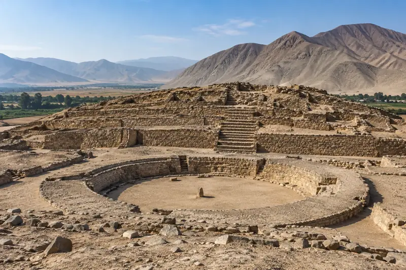
How to read the site. The marked route lets you read the city through its layout: the pyramids of the upper half, the amphitheatre and its tiers, the residential quarters of the lower half. An interpretation guide helps a great deal; the site offers them for small groups. The Áspero site, on the coast near Supe, was the associated fishing village; Vichama and Peñico, opened in 2025, complete the “Caral route”.
| Practical details | Detail |
|---|---|
| Opening hours and entry | every day from 9:00 to 17:00, last entry at 16:00; S/ 11 per site for an adult, Peruvian or foreign |
| Access | The northern Pan-American Highway to Supe, then a road up the valley; nearly 200 km from Miraflores |
| Accessibility | The route is long, in the sun, on sandy ground: check before coming with reduced mobility |
| What to bring | Water, a hat, sun cream; few services on site |
Lachay and the lomas
A desert that turns green under the fog. The lomas are coastal hills which, in winter, receive moisture from the low clouds coming in from the Pacific. With no rain, the fog is enough to make grasses, flowers, shrubs and small trees such as the tara grow: for a few months, the desert becomes a meadow. The Lachay National Reserve, 105 km north of Lima, protects one of the best-preserved examples, with traces of ancient human occupation (terraces, tombs, rock paintings).
When to go. The green season runs from June to November, with the flowering from June to September. Out of season, the walk is still possible but the landscape looks like the rest of the desert: the very green photos only apply to the southern winter.
The trails. According to SERNANP, there are four routes: the Fox trail, short and accessible to everyone, to the Cerro La Virgen viewpoint; the Tara trail, to a spring frequented by birds; the Partridge trail, longer and more difficult, for birdwatchers; and the Cruce viewpoint, over the Hierbabuena ravine. You can see desert foxes, birds of prey such as buzzards and kestrels, burrowing owls and, with luck, deer.
| Practical details | Detail |
|---|---|
| Opening hours and entry | every day from 8:00 to 15:00; S/ 30 (general rate), S/ 15 for a Peruvian adult |
| Fallback | If the fog blocks everything, stay on the short trail: the trails are marked, but visibility can drop to a few metres |
For an option closer to Lima, the Carabayllo lomas and other hills on the outskirts are presented in Which neighbourhood to choose?.
Marcahuasi
What people come to see. Marcahuasi is a plateau of about 4 km², at nearly 4,000 m, above the Santa Eulalia River valley, east of Lima. Wind, rain and perhaps ancient glaciers have sculpted large rocks there in which visitors have thought they recognised faces and animals: the “Monument to Humanity”, the “Turtle”, the “Lion”. These are natural forms that have been given names; the stories of a lost civilisation or of energies that circulate about them are not based on any data. You also find the ruins of small pre-Hispanic villages there.
Access. By the Chosica road and then up the Santa Eulalia Valley to the village of San Pedro de Casta, then on foot: a steep climb of several hours, with a large elevation gain.
A day or a night? A day trip from Lima is possible, but it combines leaving before dawn, climbing to altitude without acclimatisation and returning at night. A night on the plateau, in a tent (the “Amphitheatre” site, sheltered from the wind, is the most used), gives you time to see the rocks at sunset and sunrise, but the nights are very cold. There are no services: tent, warm sleeping bag, food and water have to be carried up from Casta.
Going so quickly from the coast to 4,000 metres exposes you to mountain sickness: headaches, nausea, tiredness. Go back down if the symptoms persist. See altitude.
Huancaya and Nor Yauyos-Cochas
The landscape. In the upper valley of the Cañete River, the Nor Yauyos-Cochas Landscape Reserve, created in 2001, protects more than 220,000 hectares of inhabited mountains. Around Huancaya, at about 3,550 m, the river descends through a succession of turquoise lagoons and waterfalls that spill over natural travertine dams, a limestone rock deposited by the water itself. The farming communities raise llamas and cattle, cultivate the terraces and fish for trout. The village has kept a colonial stone bridge and an 18th-century church.
Huancaya, Vilca and the others. Huancaya is the most visited village, with its lagoons and waterfalls within walking distance. Vilca, higher up the valley, is smaller and quieter, in the middle of the lagoons. Other villages dot the reserve (Vitis, Tanta, at the foot of Pariacaca) for those with time.
Three days, not one. From Lima, allow a day on the road on the way there and another on the way back, by the central highway or via Cañete and Lunahuaná. One day on the spot is a minimum: walking along the Huancaya lagoons, then going up to Vilca. The altitude of the nights calls for a calm first evening.
Walks. The simplest follows the river, from lagoon to lagoon, from the village. Higher walks, to high-altitude lagoons, are done with a local guide. The festival of the Señor de la Ascensión, in May, is the village’s big festival.
Other ideas for trips out
PROMPERÚ’s portal mentions other destinations in the Lima region, such as Churín and its hot springs, Canta, Huaral or Barranca. We do not cover them in detail yet: they will join this guide with proper documentation.
Frequently asked questions
Which excursion should I do if I only have half a day?
Pachacámac: half an hour from Miraflores outside rush hour, with a recent museum that explains a sanctuary more than a thousand years old. Allow three to four hours on site and for the return.
Can Caral be visited as a day trip from Lima?
Yes, but it is a long day: nearly 200 km along the northern Pan-American Highway, that is three to four hours on the road each way depending on the traffic. Leave early, with a driver or on an organised excursion.
When are the Lachay lomas green?
According to SERNANP, from June to November, with the flowering from June to September. From January to May, the hills are dry.
Sources and dates
9 sources
Prices, opening hours and rules change: every piece of information cited links to its source, with the date it was consulted.
Figures and rules cited
- Pachacámac 24 km; Punta Hermosa 36 km; Lachay 115 km; San Pedro de Casta (Marcahuasi) 96 km; Lunahuaná 173 km; Caral 193 km; Huancaya 222 km via the central highway: Road distances from Miraflores to the trips around Lima (Lima region) . Getting out of Lima alone often takes more than an hour; the mountain roads (Casta, Huancaya) are driven slowly.
Press or reseller: Road routes calculated on OpenStreetMap (FOSSGIS routing server) (new tab) · consulted on 2 October 2026 - one ticket gives access to the museum and the archaeological circuit; independent official guides, to be hired near the ticket office; electric carts and wheelchairs for visitors with reduced mobility: Pachacámac museum and sanctuary: visiting conditions (Antigua Panamericana Sur km 31.5, Lurín) . Free on the first Sunday of the month for Peruvians and foreign residents (no guides that day). The bike circuit (BiciTour) was under maintenance. Opening hours and price not shown on the pages consulted.
Site management: Pachacamac Museum, services (guiding, accessibility, BiciTour) (new tab) · consulted on 2 October 2026 - high water and class II to IV rapids from November to April; low, calmer water from May to October: Rafting (canotaje) season on the río Cañete at Lunahuaná (Río Cañete, Lunahuaná) . When the river floods, the authorities close it to tourist rafting.
Press or reseller: PROMPERÚ (Y tú qué planes), canotaje on the río Cañete (new tab) · consulted on 2 October 2026 - every day from 9:00 to 17:00, last entry at 16:00; S/ 11 per site for an adult, Peruvian or foreign: Caral archaeological zone (Caral, Áspero, Vichama, Peñico): opening hours and entry (Sacred City of Caral, Supe valley) . Each site is paid for separately; students S/ 4. Interpretation tours offered in groups of ten at most.
Site management: Zona Arqueológica Caral, opening hours and prices (new tab) · consulted on 2 October 2026 - from June to November, with the flowering from June to September: Green season of the Lachay lomas (Lachay National Reserve) . From January to May, the hills are dry.
Site management: SERNANP, Reserva Nacional de Lachay (new tab) · consulted on 2 October 2026 - every day from 8:00 to 15:00; S/ 30 (general rate), S/ 15 for a Peruvian adult: Lachay National Reserve: opening hours and entry (Lachay National Reserve, Panamericana Norte) . Free under 5; pets not allowed; stay on the marked trails.
Site management: SERNANP, Reserva Nacional de Lachay (new tab) · consulted on 2 October 2026 - nearly 4,000 m: Altitude of the Marcahuasi plateau (Marcahuasi, above San Pedro de Casta (Huarochirí))
Press or reseller: Wikipedia (Spanish), Marcahuasi (new tab) · consulted on 2 October 2026 - about 3,550 m: Altitude of the village of Huancaya (Huancaya, Yauyos) . Wikidata gives 3,586 m.
Press or reseller: Wikipedia (Spanish), Huancaya (3,554 m) (new tab) · consulted on 2 October 2026
Sources consulted
- Pachacamac Museum, the sanctuary and the museum (Ministry of Culture) (new tab) (consulted on 2 October 2026)
- Zona Arqueológica Caral, opening hours and prices (new tab) (consulted on 2 October 2026)
- SERNANP, Reserva Nacional de Lachay (new tab) (consulted on 2 October 2026)
- PROMPERÚ (Y tú qué planes), rafting on the Cañete River (new tab) (consulted on 2 October 2026)
- PROMPERÚ (Y tú qué planes), beaches south of Lima (new tab) (consulted on 2 October 2026)
- Wikipedia (English), Pachacamac, Caral, Lachay National Reserve (new tab) (consulted on 2 October 2026)
- Wikipedia (Spanish), Lunahuaná, Marcahuasi, Huancaya, Nor Yauyos-Cochas Landscape Reserve (new tab) (consulted on 2 October 2026)
- PROMPERÚ, Marcahuasi and other places to camp around Lima (new tab) (consulted on 25 September 2026)
- CDC Yellow Book, High-Altitude Travel and Altitude Illness (new tab) (consulted on 1 October 2026)
How we choose and date our information: our method. Has something changed? Let us know.