In short
For a comfortable first experience, choose Tarapoto and the San Martín region (a week, access by plane or by road). For the great flooded forest and the river, choose Iquitos, then a lodge or Pacaya Samiria (a week, access by plane). To link the two, first compare the Tarapoto–Iquitos flights available on your dates (Star Perú publishes this connection without going through Lima); a connection via Lima is another option, and the Yurimaguas route combines road and boat, with no guaranteed timetable.
The Selva is not a single destination. Do you want to combine town and excursions, spend several nights in the forest, travel for a long time by river or continue to a border? Start with this question before comparing lodges. Our two guides: Tarapoto and Iquitos.
San Martín and Loreto, two worlds
| Foothill forest (San Martín) | Plain of the great rivers (Loreto) | |
|---|---|---|
| Altitude | From 300 to over 1,000 metres: hills, valleys, waterfalls | About a hundred metres: a flat plain |
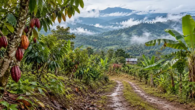
| Landscape | Wooded hills, farmed valleys (rice, coffee, cacao), lagoons | Dry-land forest, flooded forest, oxbow lakes (cochas), immense rivers |
| Access | By road and by plane | By plane or by boat, no road to the rest of the country |
| Base | Tarapoto, Moyobamba | Iquitos, then a lodge, Nauta or a boat |
| Who it suits | A first experience, without a great culture shock | A real immersion in the Amazon rainforest |
The cloud forests of Chachapoyas, in the department of Amazonas, combine with Tarapoto but belong to an Andean world: their listing is in the northern Andes.
Four bases compared
| Base | How you get there | What it allows | Limits |
|---|---|---|---|
| Tarapoto | By plane from Lima (and Tarapoto–Iquitos flights published by Star Perú); by road from Chachapoyas or the coast | Waterfalls, Lamas, the Laguna Azul, cacao, on day trips | Little great primary forest nearby |
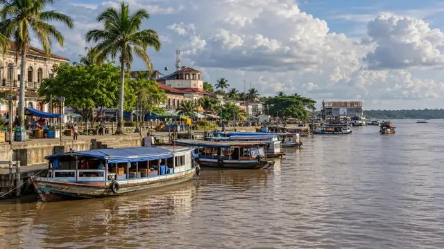
| Iquitos | By plane only (or a boat of several days) | Lodges on the Amazon and its tributaries, a historic city | The cost of boat transfers to the lodges |
| Nauta | By road from Iquitos (103 km) | Boarding for the lodges and boats of the Marañón and the Ucayali, gateway to Pacaya Samiria | A transit town rather than a destination |
| Yurimaguas | By road from Tarapoto (127 km) | A port on the Huallaga, departure point for boats to Iquitos | A long, uncomfortable river journey, with no fixed timetable |
Distances: Iquitos–Nauta 103 km (the only road out of Iquitos); Tarapoto–Ahuashiyacu waterfall 14 km; Tarapoto–Lamas 39 km; Tarapoto–Sauce 57 km; Tarapoto–Moyobamba 114 km; Moyobamba–Rioja 25 km; Tarapoto–Yurimaguas 127 km.
Why a map is not enough to link these towns
On a map, Tarapoto, Yurimaguas and Iquitos seem to be in a line. In reality, the road ends at Yurimaguas, the last town in Loreto connected to the road network. Beyond that, everything goes by water: the Huallaga joins the Marañón, then the Amazon. The Yurimaguas–Iquitos journey is made on a passenger and cargo boat, over several days, on a timetable that depends on the cargo and the water level. By plane, first compare the Tarapoto–Iquitos flights available on your dates: a Tarapoto–Iquitos connection published by Star Perú among its “intermediate” routes, with no stop in Lima. A connection via Lima is another option. These flights are not daily: fix the date of the flight before building the rest of the trip.
High and low water
In the Amazon, the season is read in the level of the rivers, which rise and fall by several metres over the year.
| High water | Low water | |
|---|---|---|
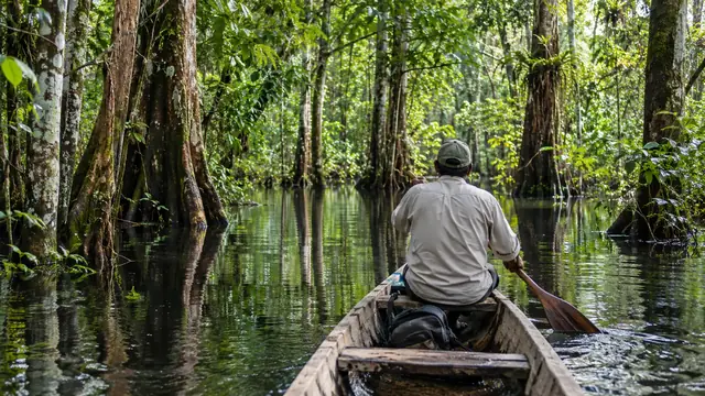
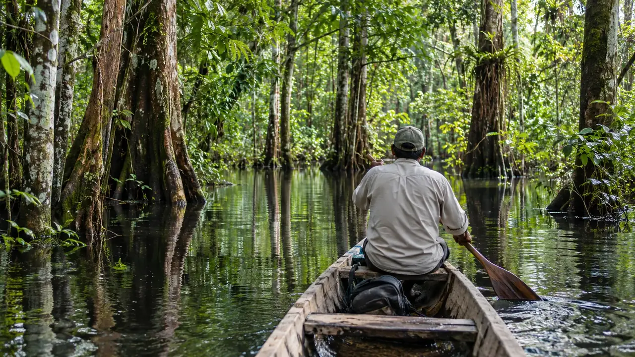
| What changes | The forest is flooded: you travel by canoe between the trunks, getting close to the canopy | The trails and beaches reappear: you walk more |
| Wildlife watching | Birds and monkeys closer by canoe; fish dispersed in the forest | Wildlife concentrated near the rivers and lakes |
| Drawbacks | Less walking possible | Some channels become impassable |
No season is “perfect”: it rains all year round, more in the wet season. SERNANP advises visiting Pacaya Samiria from May to September; PROMPERÚ advises the Alto Mayo from May to November. In 2012, an exceptional flood submerged part of Iquitos: extremes do happen.
Real nights in the forest
A stay in the forest is counted in full days, not in nights. Three nights in a lodge means, in practice, two full days of outings, as arrival and departure each take up half a day.
| Section | Nights | Full days | Who it suits |
|---|---|---|---|
| Tarapoto, without deep forest | Four in town | Four of excursions | A first experience |
| A lodge near Iquitos | Three | Two | A first stay in the forest |
| A more remote lodge or Pacaya Samiria | Five | Four | Immersion, wildlife watching |
| Tarapoto then Iquitos | Four plus four, with a Tarapoto–Iquitos flight or a connection via Lima | Six | Two weeks |
Yurimaguas
Yurimaguas, the “pearl of the Huallaga”, is a port at the confluence of the Huallaga and the Paranapura, linked by a tarmac road to Tarapoto and Moyobamba. Its big festival is that of the Assumption, on 15 August. For most travellers, it is a transit point: you board there for Iquitos, or for Lagunas, the gateway to the Tibilo sector of Pacaya Samiria.
Do not think of the boat as a bus with a fixed timetable. Check the actual departure, the type of boat (hammock or cabin), drinking water, safety on board and the current recommendations. The FDFA recommends travelling by boat only with a tour operator or trustworthy guides.
The secondary places, each for what it is
- Lamas: a hill town and its Quechua quarter of the Wayku; a day from Tarapoto. See Tarapoto.
- Moyobamba: the first Spanish town in the Peruvian Amazon, its orchids and its hot springs; two nights.
- Rioja: the upper Mayo Valley, 25 km from Moyobamba.
- Sauce: the Laguna Azul, for a day or two nights of rest.
- Tingana: a swamp forest managed by a community association, by canoe; a day from Moyobamba.
- Nauta: the embarkation point for the Marañón and Pacaya Samiria; one transit night at most.
- Pacaya Samiria: Peru’s largest reserve, with an authorised operator; four to six nights. See Iquitos.
- Yurimaguas: a port; a night before boarding.
To the tri-border area
Reaching Santa Rosa, opposite Leticia (Colombia) and Tabatinga (Brazil), from Iquitos is a project in its own right, not an ordinary extension of a stay in the forest. The FDFA advises against going to the border region with Colombia: read its up-to-date advice before considering it. Our river journey briefing details the choice of boat, the formalities and the questions to ask.
Frequently asked questions
Can you go from Tarapoto to Iquitos by road?
No. The road ends at Yurimaguas, a port on the Huallaga; from there, you have to take a boat for several days to Iquitos, with no guaranteed timetable. By plane, Star Perú publishes a Tarapoto–Iquitos connection without a stop in Lima: check whether it flies on your date. A connection via Lima remains possible.
What is the best season?
It rains all year round, more in the wet season. For Pacaya Samiria, SERNANP advises May to September; for the Alto Mayo, PROMPERÚ advises May to November. At high water, you travel by boat through the forest; at low water, you walk more.
Tarapoto or Iquitos for a first trip?
Tarapoto if you want nature without too much effort or culture shock, with a base in town. Iquitos if you really want the Amazon rainforest and the river, accepting a stay in a lodge.
Sources and dates
7 sources
Prices, opening hours and rules change: every piece of information cited links to its source, with the date it was consulted.
Figures and rules cited
- Iquitos–Nauta 103 km (the only road out of Iquitos); Tarapoto–Ahuashiyacu waterfall 14 km; Tarapoto–Lamas 39 km; Tarapoto–Sauce 57 km; Tarapoto–Moyobamba 114 km; Moyobamba–Rioja 25 km; Tarapoto–Yurimaguas 127 km: Road distances in the northern Amazon (Loreto and San Martín) . Iquitos is linked to the rest of the country only by air and by river.
Press or reseller: Road routes calculated on OpenStreetMap (FOSSGIS routing server) (new tab) · consulted on 2 October 2026 - a Tarapoto–Iquitos connection published by Star Perú among its “intermediate” routes, with no stop in Lima: Tarapoto–Iquitos flight without going through Lima (Tarapoto–Iquitos) . The airline publishes neither frequency nor days on these pages: check whether a flight exists on your date before building the itinerary.
Site management: Star Perú, intermediate routes (Tarapoto–Iquitos, Pucallpa–Iquitos, Chiclayo–Tarapoto–Iquitos) (new tab) · consulted on 7 October 2026
Sources consulted
- Star Perú, intermediate routes (Tarapoto–Iquitos without a stop in Lima) (new tab) (consulted on 7 October 2026)
- SERNANP, Reserva Nacional Pacaya Samiria (new tab) (consulted on 2 October 2026)
- PROMPERÚ, the Tingana experience (new tab) (consulted on 2 October 2026)
- Wikipedia (English), Iquitos, Nauta, Yurimaguas, Moyobamba, Tarapoto (new tab) (consulted on 2 October 2026)
- FDFA, Conseils pour les voyages – Pérou (travel advice, in French: Amazon region, Colombian border) (new tab) (consulted on 1 October 2026)
- PROMPERÚ, San Martín region (new tab) (consulted on 25 September 2026)
- PROMPERÚ, Loreto (new tab) (consulted on 25 September 2026)
How we choose and date our information: our method. Has something changed? Let us know.