In short
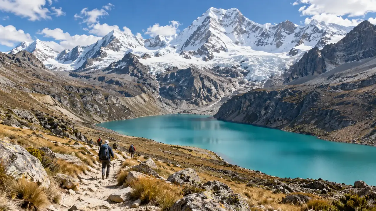
Choose a section: Huaraz and the Cordillera Blanca (a week, access from Lima); Chachapoyas and Cajamarca (ten days, access via Chiclayo or Jaén); the central Andes, Huancayo, Ayacucho and possibly Huancavelica (one to two weeks, access from Lima). The FDFA advises against the valley of the Ene, Apurímac and Mantaro rivers (VRAEM), which touches the regions of Ayacucho, Junín and Huancavelica: the towns visited are outside it, but check each journey.
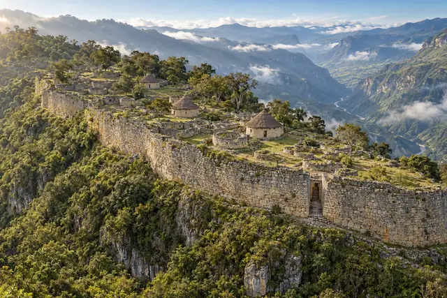
Two destinations have their own guide: Huaraz and the Cordillera Blanca, and Chachapoyas with Kuélap, Gocta, Karajía, Revash and Leymebamba. This page presents the other stops and how to put them together.
Three trips, not one
| Cordillera Blanca | Amazonas and Cajamarca | Central Andes | |
|---|---|---|---|
| Stops | Huaraz, Caraz, Chavín | Chachapoyas, Kuélap, Gocta, Leimebamba, Cajamarca | Tarma, the Mantaro Valley and Huancayo, Huancavelica, Ayacucho |
| What people come for | High mountains, lakes, hiking | Chachapoya heritage, cloud forests, the history of the conquest | Colonial towns, crafts, religious festivals, memory |
| Access | Bus or flight from Lima | Flight to Chiclayo, Jaén or Cajamarca, then by road | By road from Lima over the Ticlio pass, or a flight to Jauja (Huancayo) or Ayacucho |
| Recommended length | A week | Ten days | One to two weeks |
| Altitude of the nights | About 2,300 to 3,050 m | About 2,300 to 2,750 m | About 2,760 to 3,680 m |
Altitudes of the towns: Cajamarca about 2,750 m; Ayacucho about 2,760 m; Tarma about 3,050 m; Huancayo about 3,260 m; Huancavelica about 3,680 m. Distances: Lima–Tarma 227 km; Tarma–La Merced 74 km; Tarma–Huancayo 108 km; Lima–Huancayo 307 km; Huancayo–Jauja 49 km; Huancayo–Huancavelica 141 km; Huancayo–Ayacucho 285 km; Trujillo–Cajamarca 289 km; Chiclayo–Cajamarca 254 km.
A shared timeline, without confusing the cultures
| Period | Culture | Where to see it in this region |
|---|---|---|
| Around 1500 to 1000 BC | The builders of the Cumbemayo aqueduct | Cumbemayo (Cajamarca) |
| Around 1200 to 500 BC | Chavín, a great religious centre | Chavín de Huántar (Áncash) |
| Around 300 BC to AD 200 | Local cultures of Cajamarca | Ventanillas de Otuzco |
| Around 500 to 1000 | Wari, the first empire of the Andes | Wari (Ayacucho), Wilcahuaín (Huaraz) |
| Around 900 to 1470 | Chachapoyas | Kuélap, Karajía, Revash |
| Around 1000 to 1470 | Chancas (Ayacucho), Wankas (Mantaro) | The Ayacucho and Mantaro valleys |
| Around 1470 to 1532 | Inca | Cajamarca, Vilcashuamán, Tarmatambo |
| 1532 | Capture of Atahualpa | Cajamarca |
| 1824 | Battle of Ayacucho, end of Spanish rule | Pampa de Ayacucho, at Quinua |
These dates are orders of magnitude, debated by archaeologists; what matters is not to file under “Inca” cultures that preceded it by several centuries.
Cajamarca
At about 2,750 metres, in a green farming valley, Cajamarca is the town where Inca history changed course. In November 1532, Francisco Pizarro arrived there while the Inca Atahualpa, victorious over his half-brother in the civil war, was resting at the nearby hot springs. The Spanish captured him in the main square, demanded a ransom of gold and silver, then executed him in 1533.
In town: the Plaza de Armas and its colonial churches, the Belén monumental complex, and the “Cuarto del Rescate” (the Ransom Room), the room that tradition associates with Atahualpa’s ransom.
Around it:
- Cumbemayo, 20 km to the south-west and at around 3,500 metres: an aqueduct about 9 km long cut into volcanic rock more than three thousand years ago, steps and an altar carved into the stone, and petroglyphs in a cave, among astonishing rock formations.
- The Ventanillas de Otuzco, 8 km away: many funerary niches carved into a volcanic cliff, between 300 BC and AD 200.
- The Inca Baths, a few kilometres away: the hot springs where Atahualpa was resting, now a thermal spa.
- Granja Porcón, a mountain farming cooperative known for its planted pine forests and its livestock.
Allow three days: the town, Cumbemayo, Otuzco and the baths. Cajamarca can be reached by plane from Lima, or by road from Trujillo and Chiclayo (a day), and combines with Chachapoyas via a spectacular, very slow mountain road.
Ayacucho
Ayacucho, also called Huamanga, at about 2,760 metres, gave its name to the battle that sealed the independence of South America: on 9 December 1824, on the pampa near Quinua, the pro-independence armies defeated the royalist troops. The city is known for its 33 colonial churches, one for each year of Christ’s life according to tradition, and for its Holy Week, one of the most important in the country.
What you visit:
- The city: the Plaza de Armas and its arcades, the churches, the colonial houses, and the craftspeople’s neighbourhoods such as Santa Ana, known for their weaving.
- Wari, 11 km to the north-east: the capital of the Wari empire, which between 500 and 1000 dominated a large part of the Andes and the coast, long before the Incas.
- Quinua and the Pampa de Ayacucho, north-east of the city: the historic sanctuary of the 1824 battle, with its marble obelisk, and the village of Quinua, renowned for its ceramics.
- Vilcashuamán, further south: an Inca administrative centre with its ceremonial platform.
Crafts. The retablo ayacuchano, a painted wooden box that houses scenes in plaster or modelling paste, descends from colonial portable altars and from the “cajón de San Marcos” used for livestock rites; it was revived in the 1940s. The weaving, ceramics and Huamanga stone (a local alabaster) workshops complete the visit. Ask who makes what, and arrange workshop visits in advance.
Memory. Ayacucho was at the heart of the internal armed conflict of the 1980s and 1990s, which claimed tens of thousands of victims in the region. The city talks about it today, with restraint; in Lima, the Place of Memory (LUM) gives the context.
The FDFA advises against the valley of the Ene, Apurímac and Mantaro rivers (VRAEM), to the east of the region: do not organise any excursion in that direction. The city can be reached by plane from Lima.
Huancayo
Huancayo, at about 3,260 metres, is the big city of the Mantaro Valley, a wide farming valley of some 60 km between Jauja and Huancayo, above 3,000 metres: the granary of the central Andes, with its fields of potatoes and corn, once the land of the Wanka people. Jauja, to the north, was briefly the capital of Spanish Peru in 1534.
The craftspeople’s valley. Each village has its craft: mate burilado, gourds engraved with a burin with scenes of rural life, in Cochas; silver filigree work; weaving. You can discover them at Huancayo’s Sunday fair (feria dominical), or by visiting the workshops, as long as you let them know and buy directly from the craftspeople.
Around it: the landscapes of Huaytapallana, a glacier that rises above 5,500 metres north-east of the city, and the Paca lagoon, near Jauja.
Allow two to three days. Huancayo can be reached by road from Lima in a long day, over the Ticlio pass, above 4,800 metres: the arrival is a shock to the body, so plan a calm day. The nearest airport is at Jauja.
Tarma
Tarma, at about 3,050 metres, is a small valley town on the road that goes down from Lima to the Selva Central. Founded by the Spanish during the regrouping of populations in the 1570s, it replaced the Inca centre of Tarmatambo, on the heights, of which some remains survive. In the surrounding area, the village of San Pedro de Cajas is known for its sheep’s wool tapestries.
Tarma is above all a smart stop: spending a night there before going down to La Merced, 74 km away and more than 2,000 metres lower, breaks up a very long journey and lets you see the town, its market and its surroundings. Arriving late only to leave at dawn does not give the same experience.
Huancavelica
Huancavelica, at about 3,680 metres, is one of the highest and poorest towns in Peru. It was founded in 1572 to exploit the mercury mines of Santa Bárbara: the mercury was used to extract silver from the mines of Potosí and elsewhere, and thousands of Indigenous workers, subjected to forced labour, were exposed to its deadly fumes. The collapse of 1786 killed more than two hundred miners. This history can be visited today: the colonial town, its churches, and the former mine on the heights, to be presented as a place of memory rather than as a curiosity.
The train. The Huancayo–Huancavelica railway, nicknamed the “Tren Macho”, is a regional symbol, but its service is irregular: intermittent service: resumed on 20 December 2024 on the Chilca–Cuenca section only (57 km), on Mondays and Fridays, free of charge; suspensions reported since. Plan to go by road (141 km from Huancayo).
Keep spare days and a programme compatible with the altitude; the rainy season runs from September to January.
Three realistic sections
- The Cordillera Blanca in a week: see Huaraz.
- Amazonas and Cajamarca in ten days: a Lima–Jaén or Chiclayo flight, five days around Chachapoyas, a day on the road to Cajamarca, three days in Cajamarca, a return flight.
- The central Andes in one to two weeks: Lima–Tarma (a night), the Mantaro Valley from Huancayo (three days), then Ayacucho (three to four days, by plane via Lima or by a long road); Huancavelica for those with time.
Subjects that would deserve their own guide
Cajamarca, Ayacucho and the Mantaro Valley could each justify a full guide, with checked addresses, identified workshops and a calendar of festivals. They will come when we are able to document them on the ground.
Frequently asked questions
Can you link Huaraz, Chachapoyas and Ayacucho in a single trip?
On paper, yes; in practice it takes three to four weeks and several returns via Lima or the coast: there is no direct, fast road between these regions. One section experienced well is better than three rushed through.
Is Ayacucho safe?
The city itself is not in the area the FDFA advises against, which concerns the valley of the Ene, Apurímac and Mantaro rivers (VRAEM). Check the route of each excursion outside the city, and follow local news before you leave.
Which section for a first trip?
Huaraz, if you like mountain walking: simple access from Lima and spectacular landscapes. Cajamarca and Chachapoyas, if you prefer heritage and cloud forests.
Sources and dates
8 sources
Prices, opening hours and rules change: every piece of information cited links to its source, with the date it was consulted.
Figures and rules cited
- Cajamarca about 2,750 m; Ayacucho about 2,760 m; Tarma about 3,050 m; Huancayo about 3,260 m; Huancavelica about 3,680 m: Altitude of the towns of the northern and central Andes (town centre) (Cajamarca, Ayacucho, Junín, Huancavelica) . Huancayo: 3,256 m according to one source, 3,271 m according to another.
Press or reseller: Wikidata, altitudes (P2044) of the towns, query of 1 October 2026 (new tab) · consulted on 1 October 2026 - Lima–Tarma 227 km; Tarma–La Merced 74 km; Tarma–Huancayo 108 km; Lima–Huancayo 307 km; Huancayo–Jauja 49 km; Huancayo–Huancavelica 141 km; Huancayo–Ayacucho 285 km; Trujillo–Cajamarca 289 km; Chiclayo–Cajamarca 254 km: Road distances in the central Andes and towards Cajamarca (Central and northern Andes) . The Lima–La Oroya road crosses the Ticlio pass, above 4,800 m: a very fast climb to altitude.
Press or reseller: Road routes calculated on OpenStreetMap (FOSSGIS routing server) (new tab) · consulted on 2 October 2026 - intermittent service: resumed on 20 December 2024 on the Chilca–Cuenca section only (57 km), on Mondays and Fridays, free of charge; suspensions reported since: Huancayo–Huancavelica train (“Tren Macho”) (Huancayo (Chilca)–Huancavelica) . Do not count on this train without recent confirmation from the regional government or the Ministry of Transport.
Old source: Infobae, Tren Macho service resumes (20 December 2024) (new tab) , published on 20 December 2024 · consulted on 2 October 2026
Sources consulted
- FDFA, Conseils pour les voyages – Pérou (travel advice, in French: VRAEM, regions) (new tab) (consulted on 1 October 2026)
- Wikipedia (English), Cajamarca, Cumbemayo, Ventanillas de Otuzco, Ayacucho, Wari culture, Pampa de Ayacucho, Mantaro Valley, Huancayo, Tarma, Huancavelica (new tab) (consulted on 2 October 2026)
- Wikipedia (Spanish), Mate burilado, Retablo ayacuchano, San Pedro de Cajas, Granja Porcón, Vilcashuamán (new tab) (consulted on 2 October 2026)
- Infobae, the Tren Macho resumes service (20 December 2024) (new tab) (consulted on 2 October 2026)
- PROMPERÚ (Y tú qué planes), Cajamarca (new tab) (consulted on 26 September 2026)
- PROMPERÚ (Y tú qué planes), Ayacucho (new tab) (consulted on 26 September 2026)
- PROMPERÚ (Y tú qué planes), Junín (new tab) (consulted on 26 September 2026)
- PROMPERÚ (Y tú qué planes), Huancavelica (new tab) (consulted on 26 September 2026)
How we choose and date our information: our method. Has something changed? Let us know.