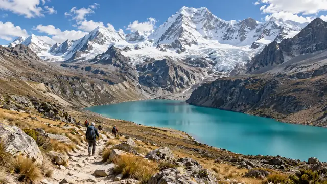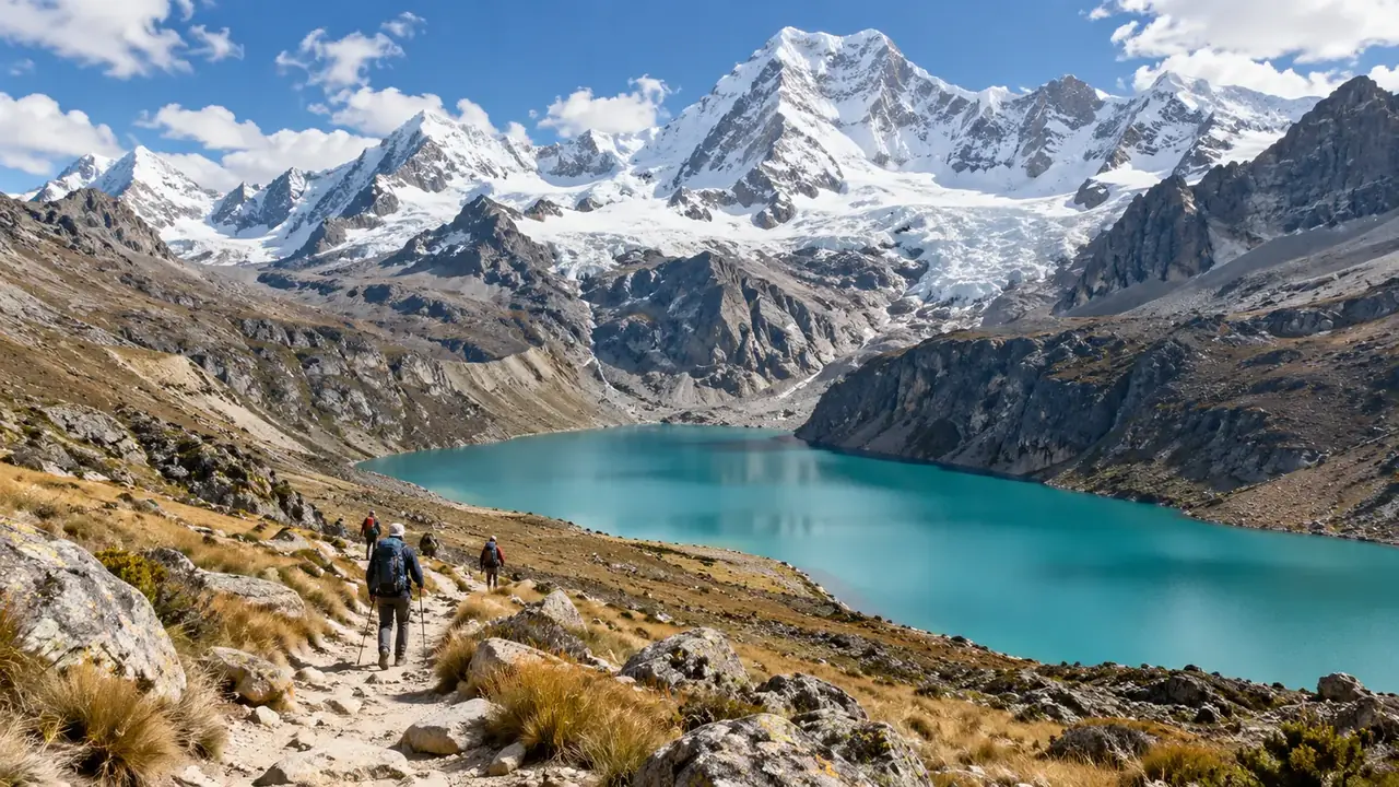
In short
Choose first according to the altitude where you will sleep and the highest pass, then according to the setting. The classic Inca Trail, 33.7 km in 4 days and 3 nights, from Piskakuchu (km 82), crosses a pass at about 4,215 m and can only be walked with a registered agency, on limited places. The Salkantay climbs higher, to about 4,630 m, with no quota. Choquequirao takes four to five days there and back, with a very long descent followed by a very long climb. Around Huaraz, Laguna 69 and Nevado Pisco must be done with a company under contract with SERNANP; for the park’s other routes, ask about the rule for the route you choose.
Twelve routes compared
| Route | Length, distance, start | Highest point | Where you sleep | Framework |
|---|---|---|---|---|
| Laguna 69 (Huaraz) | One day; about three hours of climbing from Cebollapampa (about 3,900 m) according to PROMPERÚ, then the descent, plus the drive | The lake, about 4,600 m | Huaraz or Caraz | Huascarán park: company under contract with SERNANP, compulsory since August 2025; fee specific to this route |
| Laguna Churup (Huaraz) | One day from Pitec (about 3,850 m) | The lake, about 4,450 to 4,500 m | Huaraz | Huascarán park: authorised operators; ask the park about the rule for the route |
| Santa Cruz (Cordillera Blanca) | Three to four days from Cashapampa, or the reverse from Vaquería | Punta Unión pass, 4,750 m | Tent, in the valleys | Huascarán park: authorised operators; ask the park about the rule for the route |
| Huayhuash | Ten to fourteen days for the full circuit, about 130 km, from Chiquián or Cajatambo | Several passes above 5,000 m | Tent, almost always above 4,000 m | Outside the park; specialist agency |
| Classic Inca Trail | 33.7 km in 4 days and 3 nights, from Piskakuchu (km 82) | Warmiwañusqa pass, about 4,215 m | Tent, fixed campsites | Registered agency, limited places, closed in February |
| Short Inca Trail | 10.5 km in one day, from Chachabamba (km 104) | No pass; climb towards Wiñay Wayna and the Sun Gate | Machu Picchu Pueblo | Registered agency, limited places |
| Salkantay via the Inca Trail | 42.1 km in 5 days and 4 nights, from Soraypampa, joining the Inca Trail at Wayllabamba | A pass at the foot of the Salkantay (ask the altitude), then Warmiwañusqa | Tent | Registered agency, limited places |
| Salkantay via Santa Teresa | Four to five days depending on the programme, from Soraypampa; variable distance | Salkantay pass, about 4,630 m | Tent or refuges, then the Santa Teresa valley | No quota; Machu Picchu ticket bought separately |
| Choquequirao | about 20 km from Capuliyoc (the end of the track), 27 km from the village of Cachora; two days to get there, four to five days there and back | The site, about 3,050 m, after a descent to about 1,400 to 1,500 m | Tent, campsites along the trail | Entrance fee paid at the site; no published quota |
| Vinicunca (Mountain of 7 Colours) | One day: drive from Cusco, then a walk of several kilometres | The viewpoint below the summit (about 5,040 m) | Cusco | Communities’ entrance fee; local guide advised by the FDFA |
| Palccoyo | One day: longer drive, shorter walk | The hills above the community (about 4,130 m) | Cusco | Community entrance fee |
| Colca, bottom of the canyon | Two or three days from Cabanaconde (about 3,300 m); about 6 km for some 1,050 m of descent, from 3,300 m to about 2,250 m | The start, on the rim of the canyon | Village or oasis at the bottom of the canyon | Colca tourist ticket (S/ 70 for a foreigner) |
The altitudes come from different sources (SERNANP, Wikipedia, OpenStreetMap, SRTM terrain model) and are rounded: each one is dated and detailed at the bottom of the page. They are enough for comparing; your agency must give you the exact profile of its programme.
Reading the table: what the figures do not say
- The altitude at night matters more than the pass. You cross a pass in an hour; you sleep eight hours at the campsite. On the classic Inca Trail, the campsites stay below the pass; the one at Llulluchapampa, just before it, is at around 3,800 m. A night in a tent above 4,000 m, as on the Huayhuash, needs different preparation.
- The descent is as tiring as the climb. At Choquequirao, you descend about 1,500 m to the Apurímac before climbing back up as much; in the Colca, the climb back up from Sangalle is done early, before the heat. Your knees will remember it.
- The heat at the bottom of canyons. The bottom of the Apurímac canyon is hot and humid, with mosquitoes, while the start is cool: set off early and carry water.
- The drive before the walk. A day trip from Huaraz or Cusco often starts before dawn, with several hours on dirt roads. The tiredness from the drive adds to that of the walk.
- Distances. They vary according to the actual starting point: Choquequirao is about 20 km from the end of the track, 27 from the village. Ask where your programme starts.
The Inca Trail, the Salkantay and Choquequirao: three experiences
The Inca Trail is a historic path, paved in places, dotted with Inca sites (Runkurakay, Sayaqmarka, Phuyupatamarka, Wiñay Wayna), which reaches Machu Picchu through the Sun Gate. It is also the most regulated:
- places are sold only to registered agencies, which must send the named list of walkers, guides and crews;
- about 500 people, including porters, cooks and guides, of whom about 200 are hikers: book months in advance for the high season;
- walking is allowed from 5:30 to 14:00, and the entrance fee is S/ 292 per adult for the 3 to 5-day routes, S/ 222 for the short one-day route; students S/ 147 and S/ 112, generally included in the agency’s price;
- the trail closes every year in February: the whole of February, for maintenance and safety in the rainy season (1 to 28 February in 2026);
- entry into the citadel then takes place by route 3-B only, on reserved daily places, bought through a registered agency.
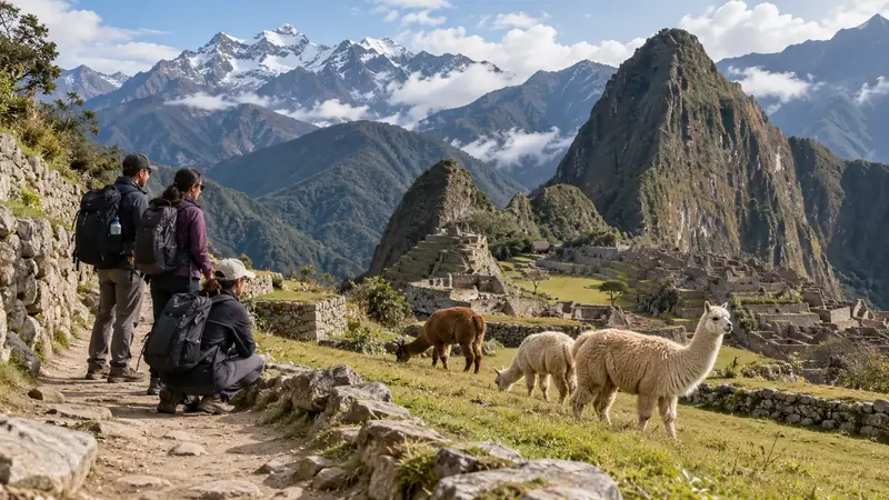
The Salkantay is a high-mountain trek at the foot of a peak over 6,000 m, which then descends towards the cloud forest. Two versions exist: route 3 of the network, which joins the Inca Trail and follows its rules, and the commercial programme via the Santa Teresa valley, with no quota, which ends by train or on foot towards Machu Picchu Pueblo. A “Salkantay trek” is never the ascent of the summit, which is a mountaineering climb.
Choquequirao is another Inca city, above the Apurímac canyon, that can only be reached on foot. You go for the trail, the site and the peace: it receives far fewer visitors than Machu Picchu. The price is the effort, with a very long descent followed by a very long climb, to be done twice.
The Lares, shorter, crosses weaving villages: 33 km in three days, a pass at Ipsaycocha at around 4,450 m, the first night at Huacahuasi at around 3,750 m, arriving at Ollantaytambo; no permit required.
Around Huaraz: one park, several rules
In Huascarán National Park, the rule is read route by route. For Laguna 69 and Nevado Pisco, visits only with an agency under contract with SERNANP, which buys the digital ticket: since 9 February 2026 for Laguna 69, since 1 April 2026 for Nevado Pisco. For the other routes, the park’s visitor page states that visits are made with authorised operators; for Churup or Santa Cruz, ask the park or the operator about the rule for your route. The entrance fee: S/ 30 for one day, S/ 60 for two to three days, S/ 150 for four to thirty days (general rate); you must use operators authorised by SERNANP. Check that a provider appears on the park’s list of authorised operators, and be wary of old advice saying that you can simply set off alone with a ticket.
Gradual progress matters more than anything: two quiet days in Huaraz, an intermediate outing such as Llanganuco or Churup, then Laguna 69. See Huaraz and the Huaraz and the mountains itinerary.
Porters, muleteers, cooks: what else you are paying for
On a multi-day trek, a team carries the tents, kitchen and supplies: porters on the Inca Trail, muleteers and their animals on most other routes. Law 31614 regulates porters’ work: up to 20 kg for a man and 15 kg for a woman, under the supervision of the labour inspectorate, with meals, equipment, shelter to sleep in and insurance paid by the employer, and a ban on employing under-18s.
Ask the agency how many people accompany the group, how much the bag you hand over weighs, where the team sleeps and eats, and whether it is insured. An offer that is markedly cheaper than the others often saves on these points. See porters and guides.
Equipment: provided, rented or to bring
| Item | The question to ask |
|---|---|
| Tent | For how many people, put up by whom? |
| Mat and sleeping bag | Provided or rented? For what temperature? Nights drop below zero at altitude during the dry season |
| Poles | Provided, rented, or to bring? |
| Water | Boiled, filtered, or to buy along the way? |
| Bag handed to the team | What maximum weight, and carried by whom? |
| Emergency horse or mule | Planned, and at what price? |
| Meals | Which diets are possible (vegetarian, allergies)? |
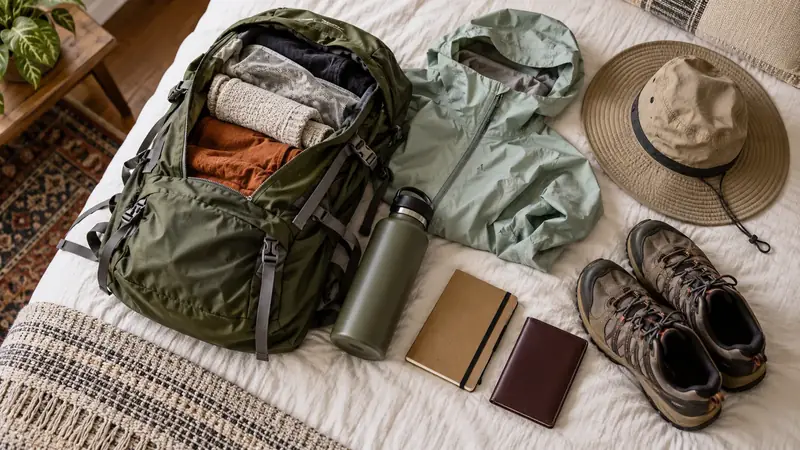
In any case, bring: broken-in boots, warm layers, rain protection, hat and sun cream, head torch, personal first-aid kit.
Turning back, insurance, limits
- Turning back. Ask how you leave the route if there is a problem: on foot to a road, on horseback, and in how many hours. On most treks, no vehicle can reach you.
- Insurance. Check that it covers hiking at the planned altitude, evacuation and repatriation; read the exclusions (altitude, sports, helicopter).
- Limits. Altitude sickness symptoms that get worse mean you must go down, even if the group carries on. A good guide will suggest it themselves. See altitude.
- Weather. From December to March, rain, mud and snow-covered passes; some routes are closed or not recommended. See when to go.
Acclimatisation: an order, not a green light
Above 3,000 m, the CDC recommends not increasing your sleeping altitude by more than 500 m per night, and adding a night for every 1,000 m. No number of days guarantees that you will be ready: it only gives the order in which to climb. Place the trek after several nights in the region, after an intermediate outing with no difficulty, and keep a spare day to postpone the start.
The questions to ask before booking
| Item | Question | Why |
|---|---|---|
| Walking | How many hours of actual walking per day, excluding breaks? | A programme can hide long days |
| Terrain | What ascent and descent each day? | The descent is tiring too |
| Nights | Where do you sleep, at what altitude, with what equipment? | Recovery is part of the trek |
| Group | What maximum size, what pace? | The price does not tell you whether the group suits you |
| Guiding | Who actually accompanies you, and in what language? | The person who sells may subcontract the outing |
| Authorisation | Is the operator authorised by SERNANP or registered for the Inca Trail? | Without authorisation, no access |
| Team | How many porters or muleteers, insured? | The quality of the trek depends on it |
| Turning back | How do you leave the route? | A vehicle cannot necessarily reach you |
| Machu Picchu | Which ticket, which route, which time slot are included? | The name of the trek does not guarantee a specific visit |
Frequently asked questions
Can you do the Inca Trail without an agency?
No. Places are sold only to registered agencies, and SERNANP requires an authorised operator. You have to book well before your trip, especially as the trail closes every year in February.
Is the Salkantay harder than the Inca Trail?
It climbs higher (pass at about 4,630 m, compared with about 4,215 m for the Inca Trail); the distances depend on the programme. It has no quota and can be booked later. The difficulty depends above all on your acclimatisation and the number of hours of walking per day: ask about them.
How many days after arriving in Cusco can you set off on a trek?
No number of days counts as a green light. Above 3,000 m, the CDC recommends not raising your sleeping altitude by more than 500 m per night. Plan several days in the region, an intermediate outing with no difficulty, and the option of turning back.
Sources and dates
10 sources
Prices, opening hours and rules change: every piece of information cited links to its source, with the date it was consulted.
Figures and rules cited
- 33.7 km in 4 days and 3 nights, from Piskakuchu (km 82): Route 1 of the network, the classic Inca Trail (Historic Sanctuary of Machu Picchu) . Walking allowed from 5:30 to 14:00; authorised operators compulsory. A route 6 (25.9 km, Mollepata–km 82 or 88, 4 days) reaches the valley without entering the Llaqta.
Site management: SERNANP, Santuario Histórico de Machupicchu (tourist routes) (new tab) · consulted on 2 October 2026 - about 4,215 m: Altitude of the Warmiwañusqa pass, the highest point of the classic Inca Trail (Inca Trail) . Llulluchapampa campsite at around 3,800 m before the pass, according to the same source.
Press or reseller: Wikipedia (English), Inca Trail to Machu Picchu (new tab) · consulted on 2 October 2026 - about 4,630 m: Altitude of the Salkantay pass (Abra Salkantay), the highest point of the trek (Salkantay trek) . Agencies give 4,600 to 4,650 m. Usual start at Soraypampa, at around 3,900 m (SRTM).
Press or reseller: OpenStreetMap, Abra Salkantay (altitude entered 4,629 m) (new tab) · consulted on 2 October 2026 - about 3,900 m: Altitude of Cebollapampa, the start of the walk to Laguna 69 (Huascarán National Park)
Press or reseller: OpenStreetMap, Cebollapampa (altitude entered 3,910 m) (new tab) · consulted on 2 October 2026 - about 4,600 m: Altitude of Laguna 69 (Huascarán National Park) (Laguna 69, Cordillera Blanca) . Wikidata gives 4,625 m.
Official source: PROMPERÚ (Y tú qué planes), Laguna 69 (4,604 m) (new tab) · consulted on 26 September 2026 - about 3,850 m: Altitude of Pitec, the start of the walk to Laguna Churup (Huascarán National Park)
Press or reseller: SRTM 30 m terrain model (OpenTopoData): 3,848 m (new tab) · consulted on 2 October 2026 - about 4,450 to 4,500 m: Altitude of Laguna Churup (Huascarán National Park)
Press or reseller: OpenStreetMap, Laguna Churup (altitude entered 4,450 m) (new tab) · consulted on 2 October 2026 - 4,750 m: Altitude of the Punta Unión pass, the highest point of the Santa Cruz trek (Huascarán National Park) . Western start at Cashapampa, at around 2,900 to 3,000 m (OpenStreetMap 2,970 m, SRTM 2,921 m).
Site management: SERNANP, Parque Nacional Huascarán (Santa Cruz–Huaripampa trekking circuit) (new tab) · consulted on 2 October 2026 - 10.5 km in one day, from Chachabamba (km 104): Route 5 of the network, the short Inca Trail (Historic Sanctuary of Machu Picchu)
Site management: SERNANP, Santuario Histórico de Machupicchu (tourist routes) (new tab) · consulted on 2 October 2026 - 42.1 km in 5 days and 4 nights, from Soraypampa, joining the Inca Trail at Wayllabamba: Route 3 of the network, via Salkantay (Historic Sanctuary of Machu Picchu)
Site management: SERNANP, Santuario Histórico de Machupicchu (tourist routes) (new tab) · consulted on 2 October 2026 - about 20 km from Capuliyoc (the end of the track), 27 km from the village of Cachora; two days to get there, four to five days there and back: Walking distance to Choquequirao (Choquequirao) . Wikipedia (English) gives about 20 km from Cachora: the two versions do not count from the same starting point.
Press or reseller: Wikipedia (Spanish), Choquequirao (access via Cachora) (new tab) · consulted on 2 October 2026 - about 3,050 m: Altitude of the Choquequirao site (Choquequirao (Cusco and Apurímac))
Press or reseller: Wikipedia (English), Choquequirao (3,050 m) (new tab) · consulted on 2 October 2026 - about 1,400 to 1,500 m: Altitude of the Playa Rosalina bridge over the Apurímac, the lowest point of the Choquequirao trail (Apurímac)
Press or reseller: Wikipedia (Spanish), Choquequirao (1,400 m) (new tab) · consulted on 2 October 2026 - about 5,040 m: Altitude of the summit of Vinicunca (the Mountain of 7 Colours) (Vinicunca, provinces of Quispicanchi and Canchis) . The same article also gives “about 5,200 m” for the pass: bear in mind that the walk takes place above 4,500 m.
Press or reseller: Wikipedia (English), Vinicunca (5,036 m) (new tab) · consulted on 2 October 2026 - about 4,130 m: Altitude of the Palccoyo community (starting point for visiting the coloured hills) (Palccoyo, Checacupe district) . The coloured hills rise above the community: the walk takes place higher up.
Press or reseller: Wikipedia (Spanish), Palccoyo (4,134 m) (new tab) · consulted on 2 October 2026 - about 3,300 m: Altitude of Cabanaconde, the starting village for walks into the Colca Canyon (Cabanaconde, Colca)
Press or reseller: Wikidata, Cabanaconde (Q27728577), altitude (new tab) · consulted on 2 October 2026 - about 6 km for some 1,050 m of descent, from 3,300 m to about 2,250 m: Descent from Cabanaconde to the Sangalle oasis, at the bottom of the Colca Canyon (Colca Canyon) . Altitude of Cabanaconde: Wikidata. The climb back up uses the same path.
Press or reseller: Walking route calculated on OpenStreetMap (FOSSGIS routing server) (new tab) · consulted on 2 October 2026 - S/ 70: Colca boleto turístico (AUTOCOLCA), foreign adult (Colca valley (Chivay checkpoint or Arequipa ticket office, Portal de la Municipalidad 112)) (Foreign adult) . On sale at the Arequipa ticket office, at the Chivay checkpoint and online (AUTOCOLCA). The amount may change.
Old source: Arequipa.com, Colca Canyon Travel Guide 2026 (new tab) · consulted on 1 October 2026 - about 500 people, including porters, cooks and guides, of whom about 200 are hikers: Number of people allowed on the classic Inca Trail each day (Machu Picchu Inca trail network) . Figure given by the agencies; it may change from one year to the next.
Old source: Wikipedia (English), Inca Trail to Machu Picchu (Permits section) (new tab) · consulted on 2 October 2026 - S/ 292 per adult for the 3 to 5-day routes, S/ 222 for the short one-day route; students S/ 147 and S/ 112: Entry fee for the Inca trail network (SERNANP) (Historic Sanctuary of Machu Picchu) (Adult and student; the page gives no rate by nationality) . Paid by the agency, usually included in its price: have it spelt out on the quote.
Site management: SERNANP, Santuario Histórico de Machupicchu (entry fees in force) (new tab) · consulted on 2 October 2026 - the whole of February, for maintenance and safety in the rainy season (1 to 28 February in 2026): Annual closure of the Machu Picchu Inca Trail network (Machu Picchu Inca trail network) . Closure announced every year by the Cusco Directorate of Culture; the Machu Picchu site stays open.
Press or reseller: Infobae, network reopening on 1 March (26 February 2026) (new tab) , published on 26 February 2026 · consulted on 2 October 2026 - by route 3-B only, on reserved daily places, bought through a registered agency: Entry to the Llaqta for walkers arriving via the Inca Trail network (Llaqta de Machu Picchu) . Ministerial resolutions 000333-2026-MC and 000334-2026-MC.
Press or reseller: Andina, the changes to visits to Machu Picchu and to the Inca trail network (12 September 2026) (new tab) , published on 12 September 2026 · consulted on 2 October 2026 - 33 km in three days, a pass at Ipsaycocha at around 4,450 m, the first night at Huacahuasi at around 3,750 m, arriving at Ollantaytambo; no permit required: Lares trek (classic route) (Lares valley, Cusco) . Several variants exist, including nights in local homes.
Press or reseller: Wikipedia (English), Lares trek (new tab) · consulted on 2 October 2026 - visits only with an agency under contract with SERNANP, which buys the digital ticket: since 9 February 2026 for Laguna 69, since 1 April 2026 for Nevado Pisco: Laguna 69 and Nevado Pisco (Llanganuco sector): access through a contracted company (Huascarán National Park, Llanganuco sector) . The park’s other circuits, such as Chinancocha lake at Llanganuco, are still sold directly, online or at the checkpoints, according to Gestión.
Press or reseller: Gestión, Laguna 69 and Nevado Pisco: visits with authorised agencies only (27 January 2026) (new tab) , published on 27 January 2026 · consulted on 8 October 2026 - S/ 30 for one day, S/ 60 for two to three days, S/ 150 for four to thirty days (general rate); you must use operators authorised by SERNANP: Huascarán National Park: entry fee and the rule on operators (Huascarán National Park, Cordillera Blanca) . The rule on operators appears on the park’s visitor page, for the protected area; how it applies route by route (Churup, Llanganuco lakes, Santa Cruz, Parón) should be confirmed with the park. Separate rate for the Laguna 69 and Pico Mateo routes; Peruvian adults S/ 12 for one day. Register at the checkpoints.
Site management: SERNANP, Parque Nacional Huascarán (new tab) · consulted on 7 October 2026 - up to 20 kg for a man and 15 kg for a woman, under the supervision of the labour inspectorate: Maximum load for a porter on a tourist expedition in Peru (Peru (Inca Trail, treks, expeditions)) . Law 31614 repeals law 27607. It forbids employing porters under 18 and makes the employer responsible for meals, clothing, protective equipment, gear for sleeping under shelter, accident insurance and life insurance, with five days of rest before another trip.
Official source: Congress of Peru, law 31614, new law on porters (consolidated text) (new tab) , published on 11 November 2022 · consulted on 2 October 2026
Sources consulted
- Gestión, Laguna 69 (since 9 February 2026) and Nevado Pisco (since 1 April 2026): authorised agencies only (27 January 2026) (new tab) (consulted on 8 October 2026)
- SERNANP, announcement of the supervision of Laguna 69 and Nevado Pisco (5 August 2025) (new tab) (consulted on 7 October 2026)
- SERNANP, Santuario Histórico de Machupicchu (routes of the Inca trail network, distances, hours, fees) (new tab) (consulted on 2 October 2026)
- SERNANP, Parque Nacional Huascarán (circuits, Punta Unión, fees, authorised operators) (new tab) (consulted on 2 October 2026)
- CDC Yellow Book, high-altitude travel (new tab) (consulted on 2 October 2026)
- Congress of Peru, Law 31614 on porter workers (new tab) (consulted on 2 October 2026)
- Andina, visiting rules for Machu Picchu and the Inca trail network (12 September 2026) (new tab) (consulted on 2 October 2026)
- PROMPERÚ (Y tú qué planes), Laguna 69 (new tab) (consulted on 26 September 2026)
- Wikipedia, Inca Trail to Machu Picchu, Choquequirao (English and Spanish), Lares trek (new tab) (consulted on 2 October 2026)
- OpenStreetMap (recorded altitudes, FOSSGIS walking routes) and SRTM 30 m terrain model (OpenTopoData) (new tab) (consulted on 2 October 2026)
How we choose and date our information: our method. Has something changed? Let us know.