
Northern Andes
Huaraz and the mountains in eight days
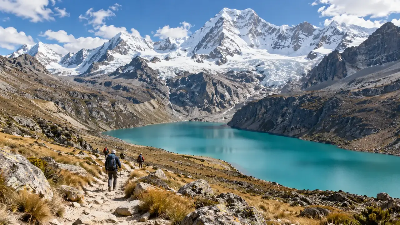
The Cordillera Blanca is discovered in stages. You always sleep in Huaraz and go up on day trips, higher and higher: a Wari site near the town, lakes you can reach by car, a great temple, then Churup and Laguna 69. No single day counts as a certificate of acclimatisation: each outing is decided the day before, depending on how you feel.
- Length
- 8 days, 7 nights
- In the country
- 8 days, 7 nights, including 2 transfer days
- Pace
- Gradual: a single base, two transfer days, a spare day
- Regions
- Northern and central Andes
Who is it for? Fit walkers who want to discover the Cordillera Blanca on day trips, without a multi-day trek.
A route to adapt to your dates, excluding international flights. Keep a day in hand before your flight home.
Day by day
TransferRestSightseeingFree day
-
Day 1
Lima, then Huaraz Transfer
Daytime bus from Lima (8 to 9 hr for most services, with daytime departures from 7:00 and night departures until around 23:40) or flight to Anta; arrival, a light dinner
Night: Huaraz (about 3,050 m)
-
Day 2
Huaraz, Wilcahuaín, Monterrey Rest
The Áncash archaeological museum, the Wari site of Wilcahuaín, the Monterrey baths: no effort at altitude
Night: Huaraz
-
Day 3
Llanganuco lakes Sightseeing
A first outing into the park, by car via Yungay, with a short walk along the lakes
Night: Huaraz
-
Day 4
Chavín de Huántar Sightseeing
The great temple and its galleries, the national museum: a cultural day, lower than the lakes
Night: Huaraz
-
Day 5
Laguna Churup Sightseeing
A short road to Pitec, then the climb to the lake: the outing that tells you whether you are ready for the next one
Night: Huaraz
-
Day 6
Laguna 69 Sightseeing
Departure at dawn, road to Cebollapampa, about three hours of climbing, then the descent and the road back
Night: Huaraz
-
Day 7
Huaraz Free day
A spare day: Laguna 69 postponed, a rest day, or Pastoruri if all is well
Night: Huaraz
-
Day 8
Huaraz, then Lima Transfer
Daytime bus to Lima, or a flight from Anta
One base, higher and higher outings
You always sleep in Huaraz, at about 3,050 m, and go up on day trips. Above 3,000 metres, the CDC recommends not increasing your sleeping altitude quickly: here, it does not change, and it is the outings that climb, stage by stage. This progression helps; it guarantees nothing. Physical fitness does not protect you from altitude sickness, and each outing is decided the day before. See altitude.
The outings, with their figures
| Day | Outing | Road from Huaraz | Start of the walk | Highest point | Walking |
|---|---|---|---|---|---|
| 2 | Wilcahuaín, Monterrey | A few kilometres | Close to the town | Short, no effort | |
| 3 | Llanganuco lakes | Via Yungay, about 90 km (60 + 29) | Lakeside | about 3,850 m | A stroll |
| 4 | Chavín de Huántar | 104 km, over a pass | The site | about 3,180 m | A visit on foot |
| 5 | Laguna Churup | 18 km to Pitec | Pitec, about 3,850 m | about 4,450 to 4,500 m | About 600 m of climbing, a steep path |
| 6 | Laguna 69 | 89 km to Cebollapampa | Cebollapampa, about 3,900 m | about 4,600 m | About three hours of climbing according to PROMPERÚ, about 700 m |
The road distances come from the OpenStreetMap calculation; the tracks to Llanganuco, Pitec and Cebollapampa are slow, and the time in the vehicle often exceeds the walking time. The starting altitudes come from OpenStreetMap and the SRTM terrain model, and the elevation gains are derived from them: these are orders of magnitude, to be confirmed by your guide.
Day by day
Day 1. The daytime bus leaves Lima in the morning, follows the coast, then climbs to the high plateaus before going down into the Callejón de Huaylas: 8 to 9 hr for most services, with daytime departures from 7:00 and night departures until around 23:40. You arrive at the end of the day; a light dinner, an early night. The flight to Anta shortens the day: LATAM flights between Lima and Huaraz airport, at Anta, some forty minutes’ drive from the town.
Day 2. No effort at altitude. In the morning, the Áncash archaeological museum, opposite the Plaza de Armas, and its park of monoliths from the Recuay culture. Then Wilcahuaín, a stone complex from the Wari period, a few kilometres away. In the afternoon, the Monterrey baths.
Day 3. The road goes up the valley to Yungay, a town destroyed by the 1970 earthquake and avalanche, then climbs to the Llanganuco lakes, between Huascarán and Huandoy. You walk little; you look.
Day 4. Chavín de Huántar, on the other side of the Cordillera Blanca: a great religious centre from almost three thousand years ago, its dark galleries, the Lanzón in its original place, the tenon heads at the national museum in the village. The road crosses a high pass, but the site is lower than Huaraz: a good transition day.
Day 5. Laguna Churup is the real rehearsal: a short road, then a steep climb of about 600 metres. If it goes well, Laguna 69 can be considered the next day; otherwise, swap it with the spare day.
Day 6. Laguna 69, a turquoise lake at the foot of Chacraraju: departure before dawn, road to Cebollapampa, about three hours of climbing, the descent, then the road. A whole day in the mountains, from dawn to evening.
Day 7. A spare day. Laguna 69 postponed if the weather prevented it, rest if tiredness sets in, or Pastoruri, a glacier south of Huaraz, at around 5,000 metres, if all is well: the walk is short but very high. The glacier is retreating fast: it has lost a large part of its surface area in three decades.
Day 8. The daytime bus to Lima, or the flight from Anta.
If the weather or the altitude decide otherwise
| Situation | A concrete alternative |
|---|---|
| Rain or low cloud | Chavín, the Áncash museum, Wilcahuaín, Monterrey: everything remains possible |
| Headaches, poor sleep | A calm day in Huaraz; Llanganuco rather than Churup |
| Churup was difficult | No Laguna 69: Parón or Llanganuco from Caraz, or Chavín |
| Symptoms getting worse | Go back down and see a doctor: see when to see a doctor |
Choosing the guide, packing your bag
- The guide: an operator authorised by SERNANP (compulsory for Laguna 69), who states the departure time, the road time and the walking time separately, the size of the group, and what they do if someone feels unwell (accompanied descent, first-aid kit). They must accept that you turn back along the way.
- The bag: warm layers and a windproof jacket, gloves and a hat, rain protection, a sun hat and sun cream, two litres of water, snacks, a head torch, walking shoes you have already worn in. The morning is freezing, the sun burns at midday.
- Insurance: check that it covers high-altitude hiking and mountain rescue.
Budget: the items to add up
| Item | Basis of calculation | Known amount |
|---|---|---|
| Lima–Huaraz bus or flight | Outward and return, per person | Your quote |
| Accommodation | 7 nights, per room | Your quote |
| Huascarán park entry | Depending on the length | S/ 30 for one day, S/ 60 for two to three days, S/ 150 for four to thirty days (general rate); you must use operators authorised by SERNANP |
| Outings with an operator | Per person, transport and guide | Your quote, park entry included or not |
| Chavín de Huántar | Site and museum entry | On site |
Variant with a base in Caraz
Caraz, at about 2,260 m, is lower than Huaraz and closer to Cebollapampa and Laguna Parón: you sleep better there, and you save road time for the two biggest outings.
| Day | Programme | Night |
|---|---|---|
| 1 to 4 | As above | Huaraz |
| 5 | Laguna Churup, then the road to Caraz | Caraz |
| 6 | Laguna 69 from Caraz | Caraz |
| 7 | Laguna Parón, or a spare day | Caraz |
| 8 | Bus to Lima |
Variant around the Santa Cruz trek
The trek is built into the middle of the stay: acclimatisation first, the trek next, the buffer last.
| Day | Programme | Night |
|---|---|---|
| 1 | Lima–Huaraz bus | Huaraz |
| 2 | Huaraz, Wilcahuaín, Monterrey | Huaraz |
| 3 | Llanganuco | Huaraz |
| 4 | Laguna Churup | Huaraz |
| 5 to 8 | The Santa Cruz trek with an authorised operator, Punta Unión pass at 4,750 m | Tent |
| 9 | Spare day and rest | Huaraz |
| 10 | Bus to Lima |
Ask for the hours of walking per day, the elevation gains, the campsites and the evacuation plan. See hiking.
What to arrange in advance
- A company under contract with SERNANP for Laguna 69 (compulsory since 9 February 2026); the Llanganuco lakes are still sold directly; for Churup, ask the park or the provider about the rule for the route. Check that the operator is on the park’s list and what the price includes (transport, guide, entry, meals).
- The daytime bus Lima–Huaraz and back, with a higher-category company; or the flight, if the date allows.
- Nothing else needs booking long in advance: outings are confirmed the day before, depending on the weather and how you feel.
What this route leaves out
- Multi-day treks (Santa Cruz, Huayhuash): see the variant built around a trek.
- Laguna Parón, easier from Caraz: see the variant with a base in Caraz.
- Summit climbs (Nevado Pisco, Alpamayo), which are mountaineering with a high-mountain guide.
Variations
-
With a base in Caraz
Two nights in Caraz, lower than Huaraz and closer to Cebollapampa and Parón. Schedule below.
-
Around the Santa Cruz trek
Ten days: acclimatisation first, the trek next, the buffer last. Schedule below.
Sources and dates
7 sources
Prices, opening hours and rules change: every piece of information cited links to its source, with the date it was consulted.
Figures and rules cited
- 8 to 9 hr for most services, with daytime departures from 7:00 and night departures until around 23:40: Length of the bus journey from Lima to Huaraz (Lima–Huaraz) . A 402 km road (OpenStreetMap calculation), which leaves the coast and climbs to the high plateaus before dropping into the Callejón de Huaylas.
Press or reseller: CheckMyBus, Lima–Huaraz (timetable aggregator) (new tab) · consulted on 2 October 2026 - about 3,050 m: Altitude of Huaraz (town) (Huaraz)
Press or reseller: Wikidata, Huaraz (Q793809), altitude (new tab) · consulted on 1 October 2026 - about 3,850 m: Altitude of Chinancocha lake (Llanganuco) (Llanganuco lakes, Yungay)
Press or reseller: Wikipedia (English), Llanganuco Lakes (new tab) · consulted on 2 October 2026 - about 3,180 m: Altitude of the Chavín de Huántar site (Chavín de Huántar, Conchucos valley)
Press or reseller: Wikipedia (English), Chavín de Huántar (new tab) · consulted on 2 October 2026 - about 3,850 m: Altitude of Pitec, the start of the walk to Laguna Churup (Huascarán National Park)
Press or reseller: SRTM 30 m terrain model (OpenTopoData): 3,848 m (new tab) · consulted on 2 October 2026 - about 4,450 to 4,500 m: Altitude of Laguna Churup (Huascarán National Park)
Press or reseller: OpenStreetMap, Laguna Churup (altitude entered 4,450 m) (new tab) · consulted on 2 October 2026 - about 3,900 m: Altitude of Cebollapampa, the start of the walk to Laguna 69 (Huascarán National Park)
Press or reseller: OpenStreetMap, Cebollapampa (altitude entered 3,910 m) (new tab) · consulted on 2 October 2026 - about 4,600 m: Altitude of Laguna 69 (Huascarán National Park) (Laguna 69, Cordillera Blanca) . Wikidata gives 4,625 m.
Official source: PROMPERÚ (Y tú qué planes), Laguna 69 (4,604 m) (new tab) · consulted on 26 September 2026 - LATAM flights between Lima and Huaraz airport, at Anta, some forty minutes’ drive from the town: Lima–Huaraz flights (Comandante FAP Germán Arias Graziani airport (Anta)) . Frequency and flight days depend on the airline and the season.
Old source: Wikipedia (English), Comandante FAP Germán Arias Graziani Airport (new tab) · consulted on 2 October 2026 - S/ 30 for one day, S/ 60 for two to three days, S/ 150 for four to thirty days (general rate); you must use operators authorised by SERNANP: Huascarán National Park: entry fee and the rule on operators (Huascarán National Park, Cordillera Blanca) . The rule on operators appears on the park’s visitor page, for the protected area; how it applies route by route (Churup, Llanganuco lakes, Santa Cruz, Parón) should be confirmed with the park. Separate rate for the Laguna 69 and Pico Mateo routes; Peruvian adults S/ 12 for one day. Register at the checkpoints.
Site management: SERNANP, Parque Nacional Huascarán (new tab) · consulted on 7 October 2026 - about 2,260 m: Altitude of Caraz (town) (Caraz)
Press or reseller: Wikidata, Caraz (Q1035471), altitude (new tab) · consulted on 1 October 2026 - 4,750 m: Altitude of the Punta Unión pass, the highest point of the Santa Cruz trek (Huascarán National Park) . Western start at Cashapampa, at around 2,900 to 3,000 m (OpenStreetMap 2,970 m, SRTM 2,921 m).
Site management: SERNANP, Parque Nacional Huascarán (Santa Cruz–Huaripampa trekking circuit) (new tab) · consulted on 2 October 2026
Sources consulted
- Gestión, Laguna 69 (from 9 February 2026) and Nevado Pisco (from 1 April 2026): authorised agencies only (27 January 2026) (new tab) (consulted on 8 October 2026)
- SERNANP, announcement of the regulation of Laguna 69 and Nevado Pisco (5 August 2025) (new tab) (consulted on 7 October 2026)
- SERNANP, Parque Nacional Huascarán (circuits, rates, authorised operators) (new tab) (consulted on 2 October 2026)
- PROMPERÚ (Y tú qué planes), Laguna 69 (new tab) (consulted on 26 September 2026)
- CDC Yellow Book, high-altitude travel (new tab) (consulted on 2 October 2026)
- CheckMyBus, Lima–Huaraz; Wikipedia, Huaraz airport (Anta) (new tab) (consulted on 2 October 2026)
- OpenStreetMap (roads, recorded altitudes) and the SRTM terrain model (new tab) (consulted on 2 October 2026)
How we choose and date our information: our method. Has something changed? Let us know.