
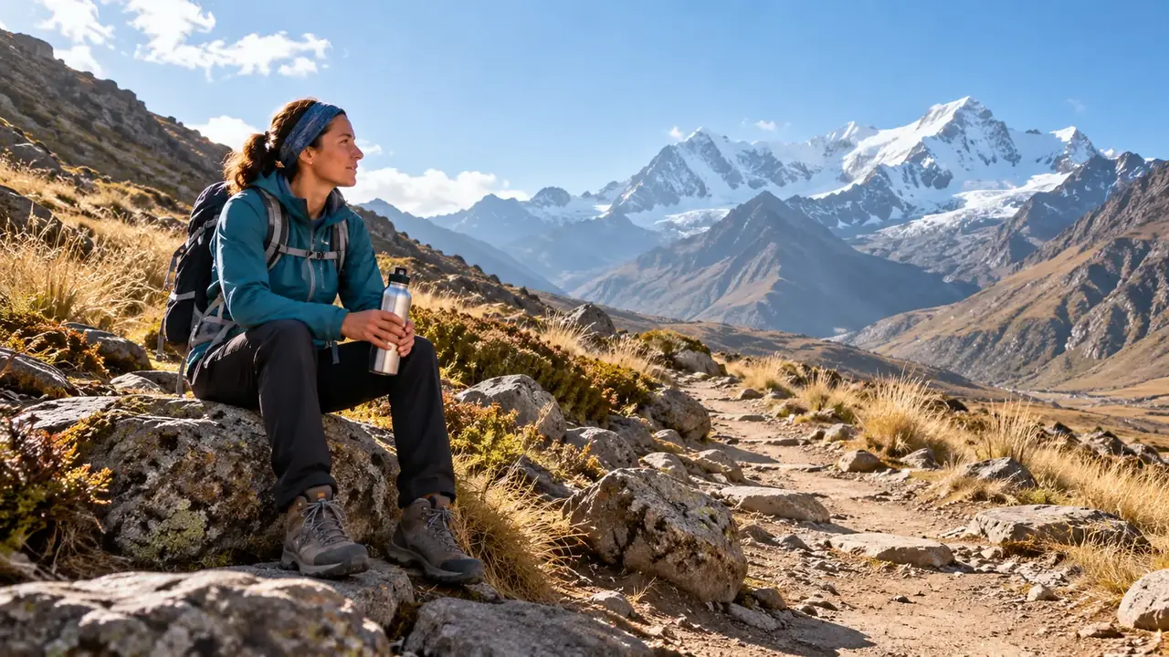
In short
Most travellers get used to the altitude in a few days; the minor complaints at the start (headache, shortness of breath, restless nights) generally pass within a day or two if you do not go any higher. Just avoid programmes that are too tight, such as day 1 Cusco, day 2 Machu Picchu, day 3 Vinicunca (the Mountain of 7 Colours). Plan instead two quiet days in Cusco, or start with the Sacred Valley, a little lower, and keep the highest outings for later. Machu Picchu is lower than Cusco. If you feel unwell and it gets worse instead of passing, go back down and see a doctor.
Three altitudes not to confuse
To plan a trip, you need to distinguish three things: the altitude where you sleep, that of the roads you cross, and that of the day excursions. The first matters most for getting used to the altitude; the other two matter mainly for the effort of the day. The CDC, the United States public health agency, puts it simply: a trip up to altitude with a return lower down in the evening tires the body far less than a night up there.
| Stop | Altitude | Type |
|---|---|---|
| Lima | Sea level | Night |
| Arequipa | about 2,335 m | Night |
| Machu Picchu Pueblo | about 2,040 m | Night |
| Machu Picchu (the site) | about 2,430 m | Excursion |
| Ollantaytambo | about 2,790 m | Night |
| Urubamba | about 2,870 m | Night |
| Huaraz | about 3,050 m | Night |
| Cusco | about 3,400 m | Night |
| Chivay (Colca) | about 3,600 m | Night |
| Puno | about 3,830 m | Night |
| Patapampa Pass, between Arequipa and the Colca | about 4,900 m | Road |
| La Raya Pass, between Cusco and Puno | about 4,320 to 4,340 m | Road |
| Chinchero | about 3,750 m | Excursion |
| Sacsayhuamán | about 3,700 m | Excursion |
| Taquile village | main village at around 3,950 m, highest point at around 4,050 m | Excursion |
| Laguna 69 | about 4,600 m | Excursion |
| Vinicunca (the Mountain of 7 Colours) | about 5,040 m | Excursion |
On the road from Arequipa to the Colca, the Patapampa Pass climbs to nearly 5,000 metres, often at dawn, before coming back down to sleep in Chivay. The crossing is short: a slight headache or shortness of breath are common there, and generally pass as you go back down. Wrap up warm, drink water and walk slowly at the viewpoint.
The body adapts in a few days
As you climb, the air always contains the same proportion of oxygen, but the pressure falls: each breath brings in a little less. At around 3,050 metres, according to the CDC, the pressure of the oxygen you breathe is only 69% of that at sea level; in Cusco or Puno, a little higher, it is slightly less again (CDC Yellow Book). A lung specialist at Peru’s Ministry of Health sums it up this way: “soroche” is not an illness in itself, but the body’s response to this air that is poorer in oxygen.
The body adapts, first by breathing faster and more deeply, then through other mechanisms: this is acclimatisation. According to the CDC, its first phase takes place over three to five days. It simply takes time, and good physical fitness cannot buy you that time: training does not change the risk. Having coped well with altitude on a previous trip is the best indication, provided you went as high and as fast; it is not a guarantee.
The first nights. Above about 2,700 metres, it is very common to sleep badly for the first few days, with irregular breathing and short pauses that wake you up. This is not a sign of illness, and it generally improves night after night.
Arriving by plane. Flying from Lima to Cusco means climbing more than 3,000 metres in an hour and a half. The body needs a few days to catch up: that is why the first days should stay calm.
When symptoms appear. Mild altitude sickness generally starts a few hours after arrival, between two and twelve hours according to the CDC. Without going any higher, it usually disappears within one to two days.
How many travellers feel it
It is common, and usually mild. Three surveys of travellers in Cusco give an order of magnitude:
| Survey | Who | Altitude sickness in the first days |
|---|---|---|
| Cusco airport, June 2010 | 991 foreign travellers on departure | 48.5% |
| Cusco airport, 2017 | 1,274 foreign travellers on departure | 37% in the first two days |
| Cohort followed from 2012 to 2016 | 142 foreign students on language courses | 39% |
Sources: Salazar and colleagues (2012), Pineda-Reyes and colleagues (2020), Caravedo and colleagues (2022). The gap between 2010 and 2017 is partly due to the criteria: the scale used since 2018 no longer counts sleep problems, which brings the figures down (Pineda-Reyes and colleagues).
Above all, these figures say that feeling the altitude is normal. In the 2017 survey, around one in five of those affected had to change their plans, by a day in bed or a missed excursion; the others carried on with their trip as planned. The two airport surveys also point to the same lesson: travellers who had first stopped somewhere lower, or in another high-altitude city, suffered less in Cusco.
The first night counts
The CDC classes the risk of altitude sickness according to the altitude where you sleep on the first night, for someone setting off from low altitude, with no serious medical history. It is a guide for choosing your first stop, not a verdict:
| First night | Risk according to the CDC | Examples in Peru |
|---|---|---|
| Below 2,750 m | Low | Arequipa, Aguas Calientes, Chachapoyas |
| From 2,750 to 3,400 m | Moderate | The Sacred Valley (Urubamba, Ollantaytambo), Huaraz, Cusco at the limit |
| Above 3,400 m | High | Puno, after a flight to Juliaca |
Above 3,000 metres, the CDC then advises not sleeping more than 500 metres higher than the previous night, and adding a night of acclimatisation for every 1,000 metres. It mentions Cusco specifically: you can go down to sleep lower than the airport for one or two nights before climbing again, which the Sacred Valley allows. A stay of at least two nights above 2,750 metres in the two preceding weeks also helps, if your trip lends itself to it.
- Solid line and dots: the altitude at which you sleep, night after night.
- Triangle: the trip to Vinicunca (the Mountain of 7 Colours), at about 5,040 metres, returning to Cusco in the evening.
- Dotted line: 2,500 metres, the altitude above which Peru’s Ministry of Health advises taking precautions.
The right pace: take your time
The most common trap is a programme that is too tight. For example:
- To avoid: day 1 in Cusco, day 2 at Machu Picchu, day 3 at Vinicunca (the Mountain of 7 Colours). Three very early starts, long drives, and the highest outing before the body has had time to get used to the altitude.
- Better: two quiet days in Cusco. You rest, walk slowly around the centre, visit the cathedral or the Qorikancha, drink a mate de coca and eat light. Then the Sacred Valley and Machu Picchu, then the big outings such as Vinicunca at the end of your stay, when you feel well.
A variant. If you prefer, go straight down to the Sacred Valley on arrival, a little lower (Urubamba or Ollantaytambo, about 2,800 m), for 2 to 3 nights, then Machu Picchu (about 2,400 m for the site, 2,000 m for the village), and only then Cusco (3,400 m). See Cusco and the Sacred Valley.
Via the south. Lima (sea level), Arequipa (2 to 3 nights, about 2,300 m), the Colca (Chivay, about 3,600 m), Puno (about 3,800 m), then Cusco. Arequipa lets you start lower; the road to the Colca climbs all at once, so keep a calm evening in Chivay. The circuit can also be done the other way round, from Cusco to Puno and then the Colca.
Towards Huaraz. The town is at about 3,050 m. Hikers usually spend two or three days there, with short walks, before Laguna 69 (about 4,600 m) or a trek. See Huaraz.
In every case, keep a spare day: you will be able to move an outing without breaking up the trip.
Day to day, up there
For the first few days, a few simple habits help. They are consistent from one source to another (CDC, Peru’s Ministry of Health, the British health service NHS):
- Slow down. Peru’s Ministry of Health advises resting for the first hours after arrival and no intense effort straight away; the CDC recommends light activity for the first 48 hours.
- No alcohol for the first two days. The CDC advises avoiding it for the first 48 hours.
- Coffee, as usual. If you drink it every day, carry on: stopping suddenly causes a headache that is easily confused with the altitude one (CDC).
- Light meals and enough to drink. Peru’s Ministry of Health advises light meals, in small portions, and drinking enough; the air at altitude is dry.
- Sun and cold. At altitude, ultraviolet radiation is stronger and the nights cold (CDC): sun cream, sunglasses, a hat, and a warm layer for the evening.
- Sleep. The first nights are often broken; it is nothing serious. Ask your doctor’s advice before taking a sleeping pill at altitude.
What you feel, and when to see a doctor
For the first few days, many travellers feel the altitude a little. This is normal, and it generally passes within a few days if you do not go any higher.
| The first few days (common, nothing serious) | Rarer: see a doctor without waiting |
|---|---|
| Slight headache | Headache that gets worse despite rest |
| Less appetite, sometimes nausea | Confusion, unusual drowsiness, behaving “as if drunk” |
| Tiredness, shortness of breath on the climbs | Balance problems, difficulty walking straight |
| Slight dizziness | Breathlessness at rest, a cough that will not go away, frothy sputum |
| Restless sleep | Extreme tiredness, unable to keep up with the group on the flat |
On the left is acute mountain sickness, the common and benign form. You slow down, stay at the same altitude, drink and eat light; for a slight headache, Peru’s Ministry of Health mentions a common painkiller such as ibuprofen. According to the NHS, symptoms generally improve within one to three days. The CDC rule is simple: never go up to sleep higher while you have symptoms, even mild ones.
On the right are rare but serious signs, which may point to high-altitude pulmonary oedema (breathlessness at rest, cough) or high-altitude cerebral oedema (confusion, balance problems). In that case there is no discussion: you go down with someone and see a doctor. The NHS advises going down 300 to 1,000 metres if symptoms get worse or do not improve after a day, and Peru’s Ministry of Health insists: faced with severe discomfort that does not ease with rest, the most effective step is to go back down. If symptoms do not pass with rest and a painkiller, it advises going to the nearest health centre (MINSA).
What to remember: you do not go up to sleep higher until you feel well; if the symptoms get worse instead of passing, you go back down. And travel with insurance that covers medical costs and repatriation: outside the big cities, medical care is limited. In an emergency, SAMU answers on 106.
Medicines: a medical decision
There are medicines that prevent altitude sickness, but they are not something to take on your own initiative. The most widely used, acetazolamide, is prescription-only: Peru’s Ministry of Health points out that it should not be taken without a prescription. The CDC recommends it mainly for travellers at moderate or high risk, for example when a rapid ascent cannot be avoided; it also mentions ibuprofen, which is less effective as prevention. The doctor decides according to your itinerary, your medical history and your treatments.
Locally, you may be advised to take tablets or remedies against “soroche”. Ask a doctor or pharmacist for advice before taking any, especially if you are already on medication.
Before you leave
In good health, most travellers need nothing more than a quiet pace. Still ask your doctor’s advice, with your day-by-day itinerary, if:
- you have heart or lung disease, or have had altitude sickness before;
- you have high blood pressure or a heart rhythm disorder: Peru’s Ministry of Health advises travelling with all your medication and after a recent check-up;
- you are just over a respiratory infection: according to a lung specialist at Peru’s Ministry of Health, it makes pulmonary oedema more likely;
- you have severe sleep apnoea or diabetes: the CDC notes that some blood glucose meters are less accurate at altitude;
- you are pregnant: the CDC advises avoiding sleeping above about 3,050 metres;
- you are travelling with young children: they are as sensitive as adults, and toddlers show it through irritability, crying, loss of appetite or paleness;
- you are planning a trek of several days or outings above 4,500 metres.
They can talk to you about a possible preventive medicine, which is prescribed case by case. This page does not replace their advice.
Treks and outings above 4,000 metres
On a trek, it is not the pass that matters most, but the altitude of the camps, and the number of days spent getting used to the altitude before setting off. A few reference points:
| Trek or outing | Highest point |
|---|---|
| Classic Inca Trail | Warmiwañusqa Pass, about 4,215 m |
| Salkantay | Salkantay Pass, about 4,630 m |
| Santa Cruz (Cordillera Blanca) | Punta Unión Pass, 4,750 m |
| Laguna 69 | about 4,600 m |
| Vinicunca (the Mountain of 7 Colours) | about 5,040 m |
Plan a few days in the starting town before setting off, choose an agency that knows how to adapt the pace and turn back, and tell them straight away if you do not feel well: it is not a failure, it is the basic rule in the mountains. See choosing your hike.
What about the coca leaf?
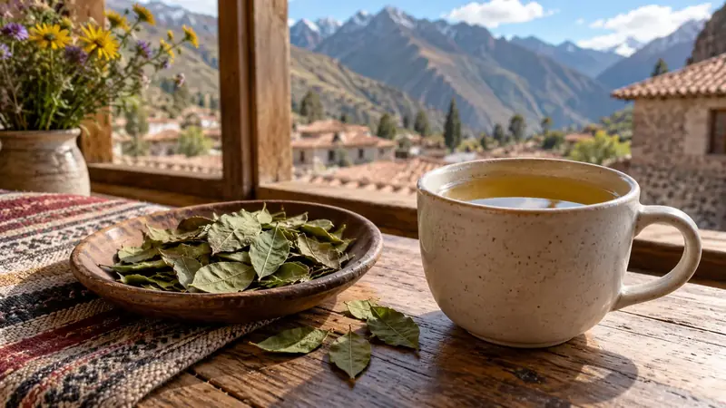
You will be offered it everywhere: as an infusion, mate de coca, often served at hotel receptions in Cusco, or as leaves to chew. Many Peruvians and travellers say it helps them cope with the altitude, and a cup on arrival is almost part of the trip. Think of it as a traditional aid rather than a medicine: it does not replace two quiet first days. See coca leaf.
A few misconceptions
“If I am fit, I am not at risk.” Physical fitness does not protect against altitude sickness; the pace does.
“Machu Picchu is the highest point of the trip.” No: the site is lower than Cusco, and the village of Aguas Calientes lower still.
“I had nothing last time, so I will have nothing this time.” It is a good sign if you went as high and as fast, but not a guarantee.
“A breath of oxygen and off you go.” A small can brings brief relief; it does not replace rest or, if it does not pass, going down.
A flexible programme and suitable support are worth more than a goal kept at all costs.
Frequently asked questions
How long does it take to get used to the altitude?
Generally a few days. According to the CDC, the first phase of adaptation takes three to five days, and the minor symptoms at the start usually disappear within a day or two if you do not go any higher. That is why two quiet days in Cusco, or a few nights in the Sacred Valley, are recommended before the big outings.
Is Machu Picchu higher than Cusco?
No. The site of Machu Picchu is at about 2,430 m and the village of Aguas Calientes, where you sleep the night before, at about 2,040 m, compared with about 3,400 m for Cusco. Going down towards Machu Picchu after a few days in Cusco is rather a respite for the body; on that day it is the tiredness of a long day, not the altitude, that counts.
Does altitude sickness depend on physical fitness?
No: according to the CDC, training and physical fitness do not change the risk. Some athletes feel it, while less trained people do not feel it at all. What matters most is the pace: going up gradually and taking it easy for the first few days.
Should you take a preventive medicine?
That is something to discuss with your doctor, especially if you have had altitude sickness before or if your programme climbs quickly. Peru’s Ministry of Health points out that acetazolamide should not be taken without a prescription. A preventive treatment is prescribed case by case; many travellers do without one by simply taking their time.
Can you go to high altitude when pregnant or with children?
Ask your doctor’s advice before you leave: the CDC advises pregnant women to avoid sleeping above about 3,050 metres. Children feel the altitude just like adults, but find it hard to express: Peru’s Ministry of Health notes that the youngest often show it only by crying that will not stop. Discuss the itinerary with a paediatrician.
Are the small cans of oxygen useful?
They bring brief relief: according to the CDC, a small can holds a few litres of oxygen at most and only gives a short respite. Oxygen given continuously, in a clinic or by a doctor, is another matter. For the minor complaints at the start, rest at the same altitude remains the first remedy.
Can you do Vinicunca (the Mountain of 7 Colours) as soon as you arrive?
Better not. You walk at about about 5,040 m there, after a very early start and a long drive. The trip is done in a day, returning to Cusco in the evening, which spares the body, but keep it for the end of your stay, when you feel well. Palcoyo mountain, lower (about 4,130 m), is another option.
Sources and dates
8 sources
Prices, opening hours and rules change: every piece of information cited links to its source, with the date it was consulted.
Figures and rules cited
- about 2,430 m: Altitude of the Machu Picchu site (Machu Picchu)
Press or reseller: Wikidata, Machu Picchu (Q676203), altitude (new tab) · consulted on 1 October 2026 - about 2,040 m: Altitude of Machu Picchu Pueblo (Aguas Calientes), at the bottom of the valley (Machu Picchu Pueblo)
Old source: Wikipedia, Aguas Calientes (Peru) (new tab) · consulted on 1 October 2026 - about 3,400 m: Altitude of Cusco (centre) (Cusco) . Wikidata gives 3,399 m, the CDC about 3,350 m: the city spreads over several tens of metres of height.
Press or reseller: Wikidata, Cuzco (Q5582862), altitude (new tab) · consulted on 1 October 2026 - about 5,040 m: Altitude of the summit of Vinicunca (the Mountain of 7 Colours) (Vinicunca, provinces of Quispicanchi and Canchis) . The same article also gives “about 5,200 m” for the pass: bear in mind that the walk takes place above 4,500 m.
Press or reseller: Wikipedia (English), Vinicunca (5,036 m) (new tab) · consulted on 2 October 2026 - about 4,130 m: Altitude of the Palccoyo community (starting point for visiting the coloured hills) (Palccoyo, Checacupe district) . The coloured hills rise above the community: the walk takes place higher up.
Press or reseller: Wikipedia (Spanish), Palccoyo (4,134 m) (new tab) · consulted on 2 October 2026 - about 2,335 m: Altitude of Arequipa (centre) (Arequipa)
Press or reseller: Wikidata, Arequipa (Q159273), altitude (new tab) · consulted on 1 October 2026 - about 2,790 m: Altitude of Ollantaytambo (village) (Ollantaytambo, Sacred Valley)
Press or reseller: Wikidata, Ollantaytambo (Q916382), altitude (new tab) · consulted on 1 October 2026 - about 2,870 m: Altitude of Urubamba (town) (Urubamba, Sacred Valley)
Press or reseller: Wikidata, Urubamba (Q2304483), altitude (new tab) · consulted on 1 October 2026 - about 3,050 m: Altitude of Huaraz (town) (Huaraz)
Press or reseller: Wikidata, Huaraz (Q793809), altitude (new tab) · consulted on 1 October 2026 - about 3,600 m: Altitude of Chivay (the main town of the Colca valley) (Chivay)
Press or reseller: Wikipedia (English), Chivay (new tab) · consulted on 1 October 2026 - about 3,830 m: Altitude of Puno (town, on the shore of Titicaca) (Puno)
Press or reseller: Wikidata, Puno (Q232842), altitude (new tab) · consulted on 1 October 2026 - about 4,900 m: Altitude of the Patapampa pass, the highest point of the Arequipa–Chivay road (Arequipa–Chivay road)
Old source: Arequipa.com, Colca Canyon Travel Guide 2026 (pass “near 4,910 m”) (new tab) · consulted on 1 October 2026 - about 4,320 to 4,340 m: Altitude of the La Raya pass, between Puno and Cusco (Puno–Cusco road)
Press or reseller: OpenStreetMap, Abra La Raya (altitude entered 4,313 m, station 4,319 m) (new tab) · consulted on 2 October 2026 - about 3,750 m: Altitude of Chinchero (village, on the plateau) (Chinchero)
Official source: Cusco Directorate of Culture, Chinchero archaeological park (average altitude 3,750 m) (new tab) · consulted on 7 October 2026 - about 3,700 m: Altitude of the Sacsayhuamán site, above Cusco (Sacsayhuamán, Cusco)
Press or reseller: Wikipedia (English), Sacsayhuamán (3,701 m) (new tab) · consulted on 2 October 2026 - main village at around 3,950 m, highest point at around 4,050 m: Altitude of Taquile island (Taquile, Lake Titicaca) . You walk up from the landing stage to the village: about 140 m above the lake.
Press or reseller: Wikipedia (English), Taquile (new tab) · consulted on 2 October 2026 - about 4,600 m: Altitude of Laguna 69 (Huascarán National Park) (Laguna 69, Cordillera Blanca) . Wikidata gives 4,625 m.
Official source: PROMPERÚ (Y tú qué planes), Laguna 69 (4,604 m) (new tab) · consulted on 26 September 2026 - 106: SAMU, medical emergencies and ambulances of the Ministry of Health (Peru (bases in Lima, Callao and most regions)) . Free service according to the ministry quoted by Andina; coverage varies outside the cities. Fire brigade: 116. A single 911 number is being trialled in Lima and Callao (Infobae, June 2026).
Press or reseller: Andina, how SAMU works, a free service (10 August 2025) (new tab) , published on 10 August 2025 · consulted on 7 October 2026 - about 4,215 m: Altitude of the Warmiwañusqa pass, the highest point of the classic Inca Trail (Inca Trail) . Llulluchapampa campsite at around 3,800 m before the pass, according to the same source.
Press or reseller: Wikipedia (English), Inca Trail to Machu Picchu (new tab) · consulted on 2 October 2026 - about 4,630 m: Altitude of the Salkantay pass (Abra Salkantay), the highest point of the trek (Salkantay trek) . Agencies give 4,600 to 4,650 m. Usual start at Soraypampa, at around 3,900 m (SRTM).
Press or reseller: OpenStreetMap, Abra Salkantay (altitude entered 4,629 m) (new tab) · consulted on 2 October 2026 - 4,750 m: Altitude of the Punta Unión pass, the highest point of the Santa Cruz trek (Huascarán National Park) . Western start at Cashapampa, at around 2,900 to 3,000 m (OpenStreetMap 2,970 m, SRTM 2,921 m).
Site management: SERNANP, Parque Nacional Huascarán (Santa Cruz–Huaripampa trekking circuit) (new tab) · consulted on 2 October 2026
Sources consulted
- CDC Yellow Book 2026, Hackett P. H. and Shlim D. R., High-Altitude Travel and Altitude Illness (page of 23 April 2025) (new tab) (consulted on 12 October 2026)
- CDC, travel to high altitudes (new tab) (consulted on 25 September 2026)
- Peru’s Ministry of Health (MINSA), recommendations to prevent altitude sickness (4 April 2026, in Spanish) (new tab) (consulted on 12 October 2026)
- NHS (United Kingdom), Altitude sickness (page reviewed on 31 July 2023) (new tab) (consulted on 12 October 2026)
- Salazar H. and colleagues, “Acute mountain sickness impact among travelers to Cusco, Peru”, Journal of Travel Medicine, 2012 (survey at Cusco airport, June 2010) (new tab) (consulted on 12 October 2026)
- Pineda-Reyes R. and colleagues, “Incidence of acute mountain sickness and healthcare related behaviors among travelers to Cusco, Peru”, Travel Medicine and Infectious Disease, 2020 (survey from 2017) (new tab) (consulted on 12 October 2026)
- Caravedo M. A. and colleagues, “Risk factors for acute mountain sickness in travellers to Cusco, Peru”, Journal of Travel Medicine, 2022 (students followed from 2012 to 2016) (new tab) (consulted on 12 October 2026)
- FDFA, Conseils pour les voyages – Pérou (travel advice, in French: mountain sickness, medical care) (new tab) (consulted on 1 October 2026)
How we choose and date our information: our method. Has something changed? Let us know.