In short
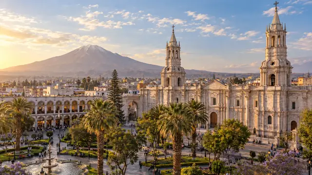
The classic route strings together two or three days in Arequipa, two days in the Colca, two days in Puno and on the lake, then Cusco by road or train; the move from Arequipa to Chivay adds about 1,300 metres of sleeping altitude in one day, which the nights in Arequipa do not make up for. In the Colca, choose between the panoramic excursion (Chivay, Cruz del Cóndor) and the trek into the canyon from Cabanaconde; on the lake, between the floating islands of the Uros, Taquile and a homestay night on Amantaní. Moquegua, Tacna and Ilo are for those with time or continuing to Chile.
Four levels of altitude
| Stop | Altitude | What it requires |
|---|---|---|
| Arequipa | about 2,335 m | A good place to start |
| Patapampa Pass, between Arequipa and the Colca | about 4,900 m | You only pass through, but it is the highest point of the road |
| Chivay, in the Colca | about 3,600 m | First night at altitude, after a gain of about 1,300 m from Arequipa: watch for symptoms |
| Cabanaconde, start of the trek | about 3,300 m | |
| Puno and Lake Titicaca | about 3,830 m; lake at about 3,810 m | Cold nights, limited effort on the first day |
Above 3,000 metres, the CDC recommends not increasing your sleeping altitude by more than 500 metres per night and planning acclimatisation days. The Arequipa–Colca–Puno route breaks this rule at one point: between Arequipa (about 2,335 m) and Chivay (about 3,600 m), the sleeping altitude gains about 1,300 metres in one day, after a pass close to 5,000 metres. Starting with Arequipa helps, but does not guarantee acclimatisation in Chivay: keep an effortless evening, a margin in the programme, and the option of going back down or turning back if symptoms appear. In the other direction, from the Sacred Valley then Cusco and Puno, the progression is more even, and you go back down towards Chivay. See altitude.
Distances: Arequipa–Chivay 151 km; Chivay–Cruz del Cóndor 45 km; Cruz del Cóndor–Cabanaconde 12 km; Chivay–Puno 273 km; Arequipa–Puno 273 km; Puno–Sillustani 33 km; Puno–Cusco 387 km; Arequipa–Moquegua 221 km; Moquegua–Ilo 74 km; Moquegua–Tacna 160 km.
Colca
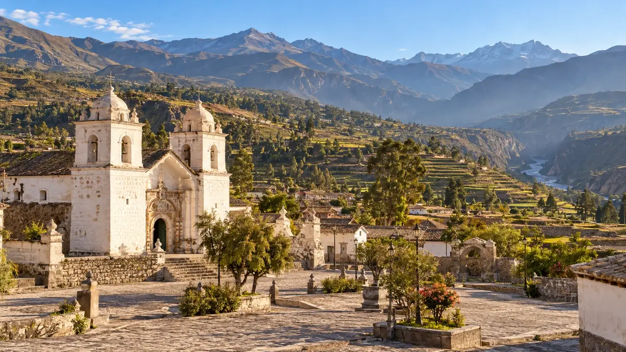
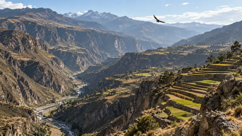
The Colca is an inhabited valley before it is a canyon. Upstream from Chivay, above 3,500 metres, people raise llamas and alpacas; downstream, the valley is covered with agricultural terraces farmed continuously since pre-Inca times by the Collaguas, who spoke Aymara, and the Cabanas, who spoke Quechua. The present-day villages (Chivay, Yanque, Coporaque, Maca, Pinchollo, Cabanaconde) were grouped together by the Spanish in the 1570s, each around its church. Further down, the river cuts deeper: the canyon reaches a depth of about 3,270 metres, making it one of the deepest in the world.
Two ways to experience it.
| Panoramic excursion | Trek into the canyon | |
|---|---|---|
| Length | Two days, a night in Chivay or Yanque | Two or three days from Cabanaconde |
| What you do | The road from Arequipa over the Patapampa Pass, villages and terraces, the Cruz del Cóndor viewpoint in the morning | A walk down to the bottom of the canyon, a night in a village or at the Sangalle oasis, the climb back up |
| Effort | Low; very high road altitude | High: about 1,000 metres down and then back up, on steep paths, in the sun |
| Who it suits | All well-acclimatised travellers | Fit walkers, after a few days in Arequipa |
Cabanaconde is at about 3,300 m; to the Sangalle oasis, about 6 km for some 1,050 m of descent, from 3,300 m to about 2,250 m. The climb back up, often done very early to avoid the heat, is the hardest part. Ask before you set off whether there is a way of getting back up if you are tired (a mule, for example) and at what price.
The condors. The Cruz del Cóndor viewpoint, near the deepest part of the canyon, is the best observation point, in the morning, when the birds make the most of the warm air currents. No serious programme can guarantee they will be there.
The ticket. Entry to the valley is subject to a tourist ticket sold by the Colca autonomous authority (AUTOCOLCA): S/ 70, checked at the entrance to Chivay.
Puno and Titicaca
Puno for its own sake. Puno is not just a port of embarkation. It is the capital of Peruvian folklore: the festival of the Virgen de la Candelaria, in February, brings together for several weeks thousands of dancers and musicians from the region’s Quechua and Aymara communities; it also changes how you get around and book (see festivals and calendar). Outside the festival, allow half a day for the town, its cathedral and the lakefront, and taste the fried trout from the lake, served with potatoes, rice and salad.
Sillustani, 33 km to the north, deserves half a day: on the shore of Lake Umayo stand chullpas, funerary towers where the Qolla and then Inca elites placed their dead. Some were left unfinished, with the ramp that was used to raise the blocks, which helps you understand how they were built.
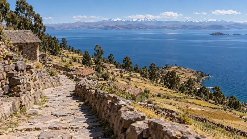
The lake and its islands. Titicaca, at about 3,810 m, is the largest lake in South America, shared between Peru and Bolivia. Three very different visits:
| Uros | Taquile | Amantaní | |
|---|---|---|---|
| What it is | About 120 inhabited floating islands made of blocks of roots and layers of reeds (totora) | An island 5.5 km long, about 45 km from Puno, inhabited by some 2,200 Quechua-speaking people | A round island of about 9 km², inhabited by more than 3,500 Quechua-speaking people, with two summits topped by temples |
| What you discover | How the islands are built, which have to be rebuilt about every twenty-five years, and the reed boats | A textile art recognised by UNESCO: the men knit, the women spin, dye and weave the belts | The life of a farming family, its terraces, its meals |
| Length | Half a day | A day | Two days, with a homestay night |
| Effort | None | A climb from the landing stage to the village, at main village at around 3,950 m, highest point at around 4,050 m | A climb to the summits if you wish |
| Good to know | A very touristy visit: the islands’ economy depends on it; you will be offered a boat ride and crafts | The community has created its own tourism organisation to regain control of the visits | Homestays are arranged through agencies and approved families; ask who receives the money |
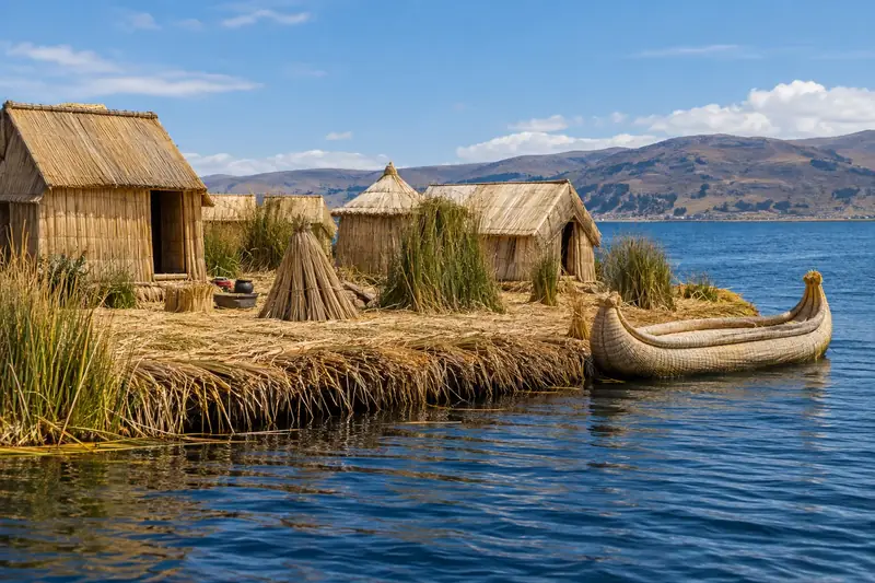
The classic “Uros and Taquile” day combines the two. A night on Amantaní, arranged in advance, lets you slow down; bring a small, useful gift (fruit, food, school supplies rather than sweets) and warm clothes. The FDFA recommends great caution in Puno and its surroundings because of strikes and blockades: check the situation before setting off, and never try to get through a roadblock.
With or without the lake: two routes compared
| With the lake | Without the lake | |
|---|---|---|
| Itinerary | Arequipa, Colca, Puno, Cusco by road or train | Arequipa, Colca, back to Arequipa, flight to Cusco |
| Length from Arequipa to Cusco | Seven to eight days | Five to six days |
| Transfers | Colca–Puno across the altiplano (a day on the road); Puno–Cusco by bus (a day) or by train (about 10 hr 30 min) | Colca–Arequipa (half a day); Arequipa–Cusco flight (about 1 hr) |
| Altitude | A steady progression up to 3,800 m | Back to 2,300 m, then arrival directly at 3,400 m |
| What you gain | The lake, the islands, the altiplano | Two or three days and less road |
Count each transfer as a day: the altiplano roads cross high passes, and you often arrive tired. The Cusco–Puno train is a daytime tourist train that does not run every day: check its timetable.
When the altitude means turning back
If the symptoms persist or get worse in the Colca or in Puno, the only measure that really works is to go back down. In practice: from Chivay, back to Arequipa the same day; from Puno, Juliaca airport lets you get to Lima. Keep changeable bookings on this part of the trip, and a spare day. Breathlessness at rest, confusion or difficulty walking require urgent medical help.
Moquegua
Moquegua, at about 1,400 metres in an irrigated desert valley, is the only valley in Peru that preserves both Wari and Tiwanaku sites. The most spectacular is Cerro Baúl, a flat-topped mountain whose summit, some 600 metres above the valley, carried a Wari outpost: D-shaped temples, elite residences, and the remains of a chicha brewery where banquets were held. The Chiribaya culture later developed in the valley and on the coast, between about the year 1000 and 1360.
In town, PROMPERÚ highlights the Plaza Mayor and its old houses (Casa de la Flor, Casa Chocano), the Santo Domingo cathedral and the church of Santa Catalina de Alejandría. The valley produces pisco and wine; on the food side, patasca moqueguana, a tripe and corn soup, is among the specialities. A day is enough for the town and Cerro Baúl, as long as you go up early, before the heat.
Tacna
Tacna, about 35 km from the Chilean border, has a strong patriotic identity: it was here that Francisco Antonio de Zela launched a first uprising for independence in 1811, and the city was occupied and administered by Chile from 1880 to 1929, before returning to Peru under the Treaty of Lima, while Arica remained Chilean. The monuments and street names keep that memory alive.
What to see according to PROMPERÚ: the Paseo Cívico and its cathedral, the railway museum devoted to the Tacna–Arica line, built in the middle of the 19th century, the Miculla archaeological complex and its petroglyphs (about 26 km from the city), and the Ite wetland for birdwatching. Give Tacna a proper day, with a lunch, rather than a wait between two buses.
To Chile. The crossing is made by road to Arica. The FDFA points out that when crossing a land border you must report to the immigration office to have your exit recorded, and that an incorrectly recorded entry can prevent you from leaving the country. Check the entry rules for Chile for your nationality. Do not count on the Tacna–Arica train without checking that it is running on your dates.
Ilo
Ilo is a port, formerly the territory of the Chiribaya culture, then olive country in colonial times, once linked to Moquegua by a railway. People come for a walk along the seafront, a fish meal and the nearby beaches presented by PROMPERÚ. It is an extension for those with time and a specific wish to see the coast: it does not need to be imposed on every first trip, and combines naturally with Moquegua (74 km).
Frequently asked questions
Should you go via Lake Titicaca?
No. Without the lake, you reach Cusco from Arequipa by plane in about an hour and save two to three days. With the lake, you climb gradually and discover another Andean culture, that of the Aymara and Quechua of the altiplano.
Uros, Taquile or Amantaní?
The Uros, reed islands near Puno, can be visited in half a day. Taquile, about 45 km away, needs a day and a climb on foot; people come for its textile art and its community organisation. Amantaní lends itself to a night with a family, arranged in advance.
Are you sure to see condors in the Colca?
No. Whether they are there depends on the season, the time of day and the weather. The morning at the Cruz del Cóndor viewpoint offers the best chances, with no guarantee.
Sources and dates
10 sources
Prices, opening hours and rules change: every piece of information cited links to its source, with the date it was consulted.
Figures and rules cited
- about 2,335 m: Altitude of Arequipa (centre) (Arequipa)
Press or reseller: Wikidata, Arequipa (Q159273), altitude (new tab) · consulted on 1 October 2026 - about 4,900 m: Altitude of the Patapampa pass, the highest point of the Arequipa–Chivay road (Arequipa–Chivay road)
Old source: Arequipa.com, Colca Canyon Travel Guide 2026 (pass “near 4,910 m”) (new tab) · consulted on 1 October 2026 - about 3,600 m: Altitude of Chivay (the main town of the Colca valley) (Chivay)
Press or reseller: Wikipedia (English), Chivay (new tab) · consulted on 1 October 2026 - about 3,300 m: Altitude of Cabanaconde, the starting village for walks into the Colca Canyon (Cabanaconde, Colca)
Press or reseller: Wikidata, Cabanaconde (Q27728577), altitude (new tab) · consulted on 2 October 2026 - about 3,830 m: Altitude of Puno (town, on the shore of Titicaca) (Puno)
Press or reseller: Wikidata, Puno (Q232842), altitude (new tab) · consulted on 1 October 2026 - about 3,810 m: Altitude of the surface of Lake Titicaca (Lake Titicaca) . The level of the lake varies by a few metres from year to year.
Press or reseller: Wikipedia (English), Lake Titicaca (3,812 m) (new tab) · consulted on 2 October 2026 - Arequipa–Chivay 151 km; Chivay–Cruz del Cóndor 45 km; Cruz del Cóndor–Cabanaconde 12 km; Chivay–Puno 273 km; Arequipa–Puno 273 km; Puno–Sillustani 33 km; Puno–Cusco 387 km; Arequipa–Moquegua 221 km; Moquegua–Ilo 74 km; Moquegua–Tacna 160 km: Road distances in the far south (Arequipa, Colca, Puno, Moquegua, Tacna) . Centre-to-centre distances. The altiplano roads cross passes above 4,000 m: actual bus times are well above the calculated driving times.
Press or reseller: Road routes calculated on OpenStreetMap (FOSSGIS routing server) (new tab) · consulted on 2 October 2026 - about 6 km for some 1,050 m of descent, from 3,300 m to about 2,250 m: Descent from Cabanaconde to the Sangalle oasis, at the bottom of the Colca Canyon (Colca Canyon) . Altitude of Cabanaconde: Wikidata. The climb back up uses the same path.
Press or reseller: Walking route calculated on OpenStreetMap (FOSSGIS routing server) (new tab) · consulted on 2 October 2026 - S/ 70: Colca boleto turístico (AUTOCOLCA), foreign adult (Colca valley (Chivay checkpoint or Arequipa ticket office, Portal de la Municipalidad 112)) (Foreign adult) . On sale at the Arequipa ticket office, at the Chivay checkpoint and online (AUTOCOLCA). The amount may change.
Old source: Arequipa.com, Colca Canyon Travel Guide 2026 (new tab) · consulted on 1 October 2026 - main village at around 3,950 m, highest point at around 4,050 m: Altitude of Taquile island (Taquile, Lake Titicaca) . You walk up from the landing stage to the village: about 140 m above the lake.
Press or reseller: Wikipedia (English), Taquile (new tab) · consulted on 2 October 2026 - about 10 hr 30 min: Length of the PeruRail Titicaca train between Cusco and Puno (Cusco (Wanchaq station)–Puno) . A daytime tourist train that does not run every day: check the calendar.
Site management: PeruRail, frequently asked questions (new tab) · consulted on 2 October 2026 - about 1 hr: Length of a direct Arequipa–Cusco flight (Rodríguez Ballón (Arequipa) and Velasco Astete (Cusco) airports) . Direct flights found with LATAM only: fewer departures than from Lima.
Press or reseller: KAYAK, Arequipa–Cusco flights (new tab) · consulted on 1 October 2026
Sources consulted
- Wikipedia (English), Colca Canyon; (Spanish), Valle del Colca (new tab) (consulted on 2 October 2026)
- AUTOCOLCA, the Colca autonomous authority (entry ticket) (new tab) (consulted on 1 October 2026)
- UNESCO, intangible heritage: Taquile and its textile art (new tab) (consulted on 2 October 2026)
- Wikipedia (English), Taquile, Amantaní, Uros, Sillustani, Lake Titicaca (new tab) (consulted on 2 October 2026)
- Wikipedia (English), Moquegua, Cerro Baúl, Tacna, Ilo (new tab) (consulted on 2 October 2026)
- PROMPERÚ, Moquegua as a destination (new tab) (consulted on 26 September 2026)
- PROMPERÚ, Tacna as a destination (new tab) (consulted on 26 September 2026)
- PROMPERÚ, the festival of the Virgen de la Candelaria (new tab) (consulted on 26 September 2026)
- CDC Yellow Book, High-Altitude Travel and Altitude Illness (new tab) (consulted on 1 October 2026)
- FDFA, Conseils pour les voyages – Pérou (travel advice, in French: Puno, border crossings) (new tab) (consulted on 1 October 2026)
How we choose and date our information: our method. Has something changed? Let us know.