
In short
Choose a section. Chanchamayo, Villa Rica, Oxapampa and Pozuzo (five to seven days from Lima via Tarma) for coffee, waterfalls, the cloud forests of Yanachaga-Chemillén National Park and the history of the Tyrolean settlers among the Yanesha and Asháninka peoples. Tingo María (two to three days) for the oilbird cave and the waterfalls of the national park. Pucallpa and Yarinacocha (three to four days, by plane) for the kené art of the Shipibo-Konibo.
Three separate trips
| Chanchamayo, Oxapampa, Pozuzo | Tingo María | Pucallpa and Yarinacocha | |
|---|---|---|---|
| Region | Junín and Pasco | Huánuco | Ucayali |
| Landscape | Foothill valleys, cloud forests, coffee | Limestone mountains covered in forest, waterfalls | A great river, lakes, the Amazonian plain |
| Access | By road from Lima via Tarma | By road from Lima via Huánuco; airport | By plane from Lima; by road via Huánuco and Tingo María |
| Length | Five to seven days | Two to three days | Three to four days |
| What people come for | Coffee, waterfalls, birds, the history of migration | The oilbird cave, waterfalls, the “Sleeping Beauty” | Kené art, lakes, life on the river |
Distances: Lima–La Merced 307 km; Tarma–La Merced 74 km; La Merced–Villa Rica 52 km; La Merced–Oxapampa 77 km; Lima–Oxapampa 383 km; Oxapampa–Pozuzo 78 km; Lima–Huánuco 402 km; Huánuco–Tingo María 121 km; Tingo María–Pucallpa 256 km; Pucallpa–Yarinacocha 7 km. Moving from one to the other costs whole days on the road: choose.
La Merced and Chanchamayo
74 km from Tarma, the road plunges more than 2,000 metres to La Merced, at about 750 metres, the capital of the province of Chanchamayo. The town was founded around 1884 by settlers, notably Italians, in a valley that the Asháninka had long defended against colonisation, particularly during the rebellion of Juan Santos Atahualpa in the 18th century; their communities still live in the region.
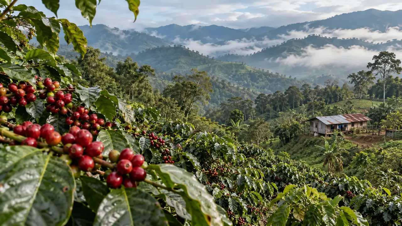
Coffee. The Chanchamayo and Villa Rica valleys are among the great coffee-growing regions of Peru. A visit to a finca lets you follow the chain: the cherries picked by hand under the shade trees, pulping, fermentation and washing, drying, then roasting and tasting. Favour a farm that explains its work and confirms in advance that it can receive you.
Waterfalls and the river. The surrounding area has many waterfalls reached by short walks, and the Chanchamayo River can be rafted depending on the season, with suitable supervision. A day with two good stops is better than a circuit packed with quick stops.
Villa Rica, 52 km away, is a small town of coffee growers; it is the best place for an in-depth coffee visit, from the plantation to the cup, and for comparing a simple tasting with the discovery of a farm.
Oxapampa and Pozuzo
Oxapampa, at about 1,800 metres, was founded in 1891 by descendants of the Pozuzo settlers. It has kept a Tyrolean-inspired wooden architecture, cattle farming and coffee, and a mild climate that has made it a tourist destination since the roads improved. Its name comes from Quechua (“straw plain”); the Yanesha, the region’s Indigenous people, call it Koshapampó.
Pozuzo, 78 km further north, in the Huancabamba Valley, is the most unusual village: in 1857, some 300 Tyrolean and Prussian peasants set sail for Peru, recruited by the government to populate the Amazonian slopes; after an exhausting journey on foot across the Andes, they founded Pozuzo in 1859. Isolated until a road was opened in 1976, the village has kept houses, a church, dances and a cuisine inherited from its founders.
Do not tell just one story. Before the settlers, the valley had seen an 18th-century Franciscan mission, destroyed during the rebellion of Juan Santos Atahualpa, and the Asháninka and Yanesha lived and farmed there. The Yanesha, about 7,000 people spread across some fifty communities between Pasco, Junín and Huánuco, speak an Arawakan language. A community visit is arranged with the people concerned, never on the spur of the moment.
Yanachaga-Chemillén National Park, which rises from 370 to 3,800 metres above Oxapampa, protects cloud forests and lowland forests, with spectacled bears, cocks-of-the-rock and hundreds of orchids. San Alberto sector 5.5 km from Oxapampa (8:00–16:00); Huampal sector 70 km away (6:00–14:00), for the cock-of-the-rock and the Huancabamba canyon; S/ 30 a day (general rate).
Distinguish the comfortable town from the nature outing: Oxapampa is visited on foot, between cafés and wooden houses; a real outing into the park requires an early start, a guide and a whole day.
Tingo María
Tingo María, at about 650 metres, at the confluence of the Monzón and the Huallaga, calls itself the “gateway to the Amazon”. It was not reached by road until 1936. It can be recognised from afar by the silhouette of the Sleeping Beauty (Bella Durmiente), a limestone ridge shaped like a reclining woman.
Tingo María National Park offers three routes:
- The Cueva de las Lechuzas: despite its name (“cave of the owls”), it is home to a colony of oilbirds (guácharos), nocturnal fruit-eating birds that find their way in the dark by making clicking sounds, and bats, among stalactites and stalagmites. Do not dazzle them: no flash.
- Tres de Mayo: three waterfalls with pools where you can swim.
- Quinceañera: a 43-metre waterfall.
S/ 30 for one day (general rate), S/ 11 for a Peruvian adult; Cueva de las Lechuzas from 8:00 to 17:30, Tres de Mayo and Quinceañera sectors from 8:00 to 15:00; 7 to 14 km from the town.
The FDFA advises against tourist travel in the isolated areas east of the city of Huánuco: find out about the situation on the road and in the surrounding area before going, travel by day, and stay at the park’s developed sites with local guides.
Pucallpa and Yarinacocha
Pucallpa, on the Ucayali, is the second river port of the Peruvian Amazon after Iquitos. Founded in the 1840s by Franciscan missionaries, it grew with timber and the road from Lima; you get there by plane or by a long road via Huánuco and Tingo María.
The land of the Shipibo-Konibo. This Pano-speaking people lives along the Ucayali and its tributaries, and around Lake Yarinacocha, an old meander of the river a few kilometres from the town. Shipibo women are known for their textiles and ceramics covered with kené, red, black and white labyrinthine geometric patterns that express their view of the world; the men carve them on wood. Kené has been recognised as cultural heritage of the Nation since 2008.
How to discover it: by buying directly from the artists, in Yarinacocha or in the riverside communities, asking who made the piece, what it represents and how long it took. For a community visit, go through a meeting agreed in advance, paid for, where you are told what can be photographed. Do not turn the residents into scenery, and be wary of programmes that associate Shipibo culture with ayahuasca ceremonies: the FDFA advises against them.
Yarinacocha is visited by boat: fishermen’s life, birds, sometimes dolphins. Puerto Callao, on the shore, is its small port.
For every section
- Health: according to the CDC, yellow fever vaccination is recommended for several Amazonian regions, including Ucayali and parts of Junín and Pasco, and malaria is present east of the Andes below 2,500 metres. See a travel medicine centre.
- Safety: the FDFA advises against the valley of the Ene, Apurímac and Mantaro rivers (VRAEM), south-east of Chanchamayo (part of the province of Satipo and beyond): do not go beyond the tourist valleys without recent information. In the Amazon region, road blockades linked to conflicts may occur.
- Weather: the rainy season, roughly from November to April, causes landslides on the mountain roads; keep a spare day.
Frequently asked questions
Can you do Oxapampa, Tingo María and Pucallpa in the same trip?
Not in a short loop: they are three regions separated by hundreds of kilometres of mountain roads. Allow nearly two weeks, or choose a single section. Pucallpa is more easily reached by plane from Lima.
What is kené?
The geometric patterns that the Shipibo-Konibo paint and embroider on textiles, ceramics, wood and the face. They express their view of the world and have been recognised as cultural heritage of the Nation since 2008. Buy them directly from the artists, who can tell you what a piece represents.
Is Pozuzo a “German” village?
It was founded in 1859 by Tyrolean and Prussian settlers, whose descendants maintain the architecture and the festivals. But the valley was inhabited long before by Indigenous peoples, notably the Asháninka and Yanesha, who had driven back the 18th-century missions: the two histories go together.
Sources and dates
9 sources
Prices, opening hours and rules change: every piece of information cited links to its source, with the date it was consulted.
Figures and rules cited
- Lima–La Merced 307 km; Tarma–La Merced 74 km; La Merced–Villa Rica 52 km; La Merced–Oxapampa 77 km; Lima–Oxapampa 383 km; Oxapampa–Pozuzo 78 km; Lima–Huánuco 402 km; Huánuco–Tingo María 121 km; Tingo María–Pucallpa 256 km; Pucallpa–Yarinacocha 7 km: Road distances in the Selva Central (Junín, Pasco, Huánuco, Ucayali) . Mountain and foothill roads: allow much more than the calculated time, especially in the rainy season.
Press or reseller: Road routes calculated on OpenStreetMap (FOSSGIS routing server) (new tab) · consulted on 2 October 2026 - San Alberto sector 5.5 km from Oxapampa (8:00–16:00); Huampal sector 70 km away (6:00–14:00), for the cock-of-the-rock and the Huancabamba canyon; S/ 30 a day (general rate): Yanachaga-Chemillén National Park: sectors, access and entry (Yanachaga-Chemillén National Park, Oxapampa) . 122,000 hectares from 370 to 3,800 m; best season from April to October. Other sectors: San Daniel, Paujil.
Site management: SERNANP, Parque Nacional Yanachaga Chemillén (new tab) · consulted on 2 October 2026 - S/ 30 for one day (general rate), S/ 11 for a Peruvian adult; Cueva de las Lechuzas from 8:00 to 17:30, Tres de Mayo and Quinceañera sectors from 8:00 to 15:00; 7 to 14 km from the town: Tingo María National Park: entry, opening hours and routes (Tingo María National Park, Huánuco) . Three routes: the Cueva de las Lechuzas (oilbirds and bats), Tres de Mayo (three waterfalls with pools), Quinceañera (a 43 m waterfall).
Site management: SERNANP, Parque Nacional Tingo María (new tab) · consulted on 2 October 2026
Sources consulted
- SERNANP, Parque Nacional Tingo María (new tab) (consulted on 2 October 2026)
- SERNANP, Parque Nacional Yanachaga Chemillén (new tab) (consulted on 2 October 2026)
- BDPI (Ministry of Culture), the Shipibo-Konibo, Yanesha and Asháninka peoples (new tab) (consulted on 2 October 2026)
- Wikipedia (English), Pozuzo, Oxapampa, La Merced, Tingo María, Pucallpa, Kené, Shipibo-Conibo, Yanesha (new tab) (consulted on 2 October 2026)
- FDFA, Conseils pour les voyages – Pérou (travel advice, in French: VRAEM, east of Huánuco, Amazon region) (new tab) (consulted on 1 October 2026)
- CDC Yellow Book, Peru (yellow fever, malaria) (new tab) (consulted on 2 October 2026)
- PROMPERÚ (Y tú qué planes), Pasco (Oxapampa, Pozuzo, Villa Rica) (new tab) (consulted on 26 September 2026)
- PROMPERÚ (Y tú qué planes), Junín (Chanchamayo, Tarma) (new tab) (consulted on 26 September 2026)
- PROMPERÚ (Y tú qué planes), Ucayali (Pucallpa, Yarinacocha) (new tab) (consulted on 26 September 2026)
How we choose and date our information: our method. Has something changed? Let us know.